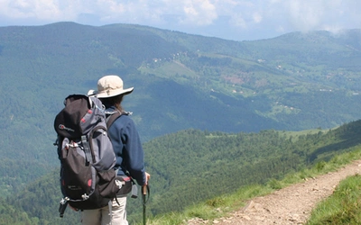
The GR5 Trail – Through the French Alps: a complete planning guide
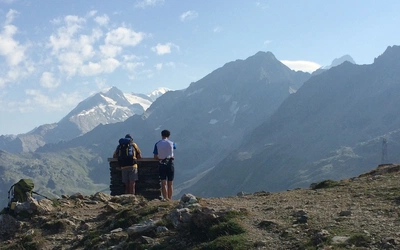
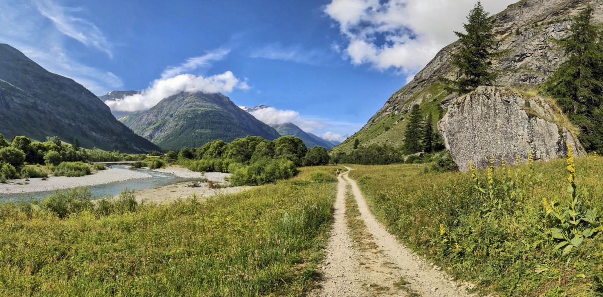
Trekking across the French Alps between Lake Geneva and Nice sounds daunting even for experienced long-distance walkers. But step back and put it in perspective: well-graded paths, strategic cols between the high peaks, and a well-established network of refuges and gîtes d'étape make this celebrated route simply a very long walk, and one that is completed without serious problems by thousands of walkers every summer. The GR5 Trail – Through the French Alps covers around 600km (373 miles) from Lac Léman to the Mediterranean in 28 stages across six sections, typically completed in four to five weeks, passing through the national parks of Vanoise, Queyras and Mercantour on the way. (Last updated: June 2026 · Guidebook edition: 4th edition, 2025)
The GR5 Trail - Through the French Alps, quick facts:
- Distance: ~591–625km / ~367–388 miles (depending on variants chosen)
- Duration: 28–40 days (full route); shorter sections easily achieved
- Start: St-Gingolph on Lac Léman (or Thonon-les-Bains, two-day variant Stages 1a/1b)
- Finish: Nice (main GR5) or Garavan/Menton (via GR52 alternative)
- Stages: 28 main stages plus alternative routes (GR55, GR5E, GR52)
- High point: Col de l'Iseran 2770m (Stage 11); variant Col des Fours 2976m (Stage 11a)
- Difficulty: Challenging; suitable for experienced, fit hill-walkers with some Alpine experience
- Terrain: High mountain passes, glacial valleys, national park wilderness, balcon paths, forested gorges, Mediterranean hill country
- Waymark: White over red rectangles (standard GR mark); red/white stripes on signposts
- Accommodation: Refuges, gîtes d'étape, chambres d'hôtes, hotels; demi-pension standard
- Best season: Late June to mid-September
- Guidebook:The GR5 Trail – Through the French Alps by Paddy Dillon, 4th edition 2025
The GR5 Trail - Through the French Alps
From Lake Geneva to Nice, including GR52 to Menton
£18.95
Discover the GR5 trail from Lac Leman (Lake Geneva) through the French Alps to the Mediterranean at Nice or Menton. The 600km (373 mile) trek takes 1 month to walk and includes all the main variant routes as it passes Mont Blanc, then through the Vanoise, Queyras and Mercantour National Parks. Includes accommodation guide, profiles and maps.
More information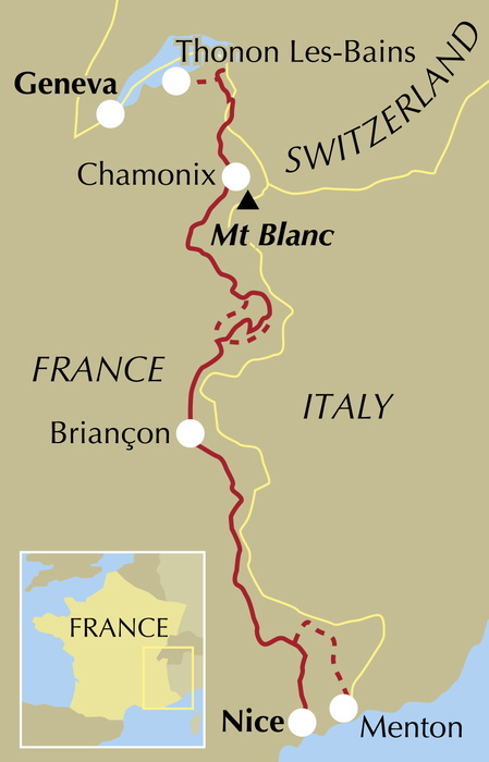
What is the GR5 Trail – Through the French Alps?
The GR5 Trail – Through the French Alps is the final and most celebrated section of the Grande Randonnée 5, a long-distance route that runs for approximately 2300km from the North Sea coast at Hoek van Holland all the way to the Mediterranean at Nice. This guidebook covers the last section: the walkers' Grand Traverse of the Alps from Lac Léman (Lake Geneva) to Nice, a journey of around 600km that passes through some of the most spectacular mountain scenery in Europe.
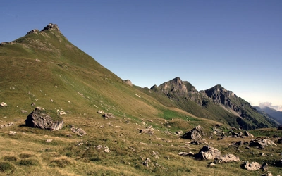
The route threads through three national parks (Vanoise, Queyras and Mercantour), passes within sight of Mont Blanc, crosses a dozen or more high mountain passes, and descends through the Maritime Alps into the warmth and colour of the Mediterranean coast. It is genuinely alpine: the high cols carry snow well into summer, the refuges smell of wet boots and good food, and on a clear day the views are the kind that walkers remember for the rest of their lives.
What distinguishes the French Alps section from the rest of the GR5 is the scale of the landscape and the corresponding scale of the daily effort required. This is not a route for walkers who are new to the hills or unused to sustained exertion. But it is equally not a mountaineering expedition. Paths are well graded and waymarked, zigzagging up steep slopes rather than tackling them directly, and only rarely does it become necessary to use hands on scrambling terrain. The GR5 is, as author Paddy Dillon puts it, just a long walk.
This planning guide answers the most common questions walkers have before setting out. For complete stage-by-stage route descriptions, variant routes, and mapping, see the Cicerone GR5 Trail – Through the French Alps guidebook.
Why does Cicerone have three GR5 guidebooks? Which one do I need?
The GR5 is approximately 2300km long, making it impossible to cover in a single practical guidebook. Cicerone divides the full trail across three volumes, each covering a distinct section with its own character, difficulty level and logistics:
| - | GR5 – Benelux and Lorraine | GR5 – Vosges and Jura | GR5 – Through the French Alps |
|---|---|---|---|
| Start | Hoek van Holland | Schirmeck (or Wissembourg via GR53) | Lake Geneva (Lac Léman) |
| Finish | Schirmeck | Lake Geneva (Lac Léman) | Nice (or Menton via GR52) |
| Distance | ~1000km / 621 miles | 687.5km / 427 miles (incl. GR53) | ~600km / 373 miles |
| Duration | 6–8 weeks | 5–6 weeks | 4–5 weeks |
| Countries | Netherlands, Belgium, Luxembourg, France (Lorraine) | France (Vosges, Alsace, Jura), Switzerland (final approach to Nyon) | France (Alps); brief sections near Italian border |
| Terrain | Flat to gently hilly; polders, heath, river valleys, plateau | Forested hills, sandstone ridges, open summits, river gorges, limestone plateau | High mountain terrain; passes, glacial valleys, national parks |
| Difficulty | Easy to moderate | Moderate | Challenging; serious alpine fitness required |
| Author | Carroll Dorgan | Les and Elizabeth Smith | Paddy Dillon |
| Stages | 49 stages | 11 GR5 sections + 3 GR53 sections | 28 main stages plus GR55, GR5E and GR52 variants |
If you are planning to walk the full GR5 end-to-end, you will need all three volumes: the Benelux and Lorraine book takes you from the North Sea to Schirmeck, the Vosges and Jura volume carries you to Lake Geneva, and this book brings you down to the Mediterranean. If you are planning a section walk, choose the volume that covers your intended start and finish points using the table above.
How long is the GR5 Trail – Through the French Alps? What are the stages?
The route runs from Lake Geneva to Nice across six sections and 28 main stages. Because the GR5 has multiple variants at several points, the guidebook provides three scheduling options: 28 days (the most direct), 31 days, and 40 days (the most leisurely, with shorter daily stages averaging 15km and 5hr 20min). Most walkers fall somewhere between these options.
Total distance ranges from 591 to 625km depending on variants chosen. In excess of 36,500m of ascent is possible if all variants are followed.
Section 1: Lac Léman to Les Houches
| Stage | Distance | Ascent/Descent | Time |
|---|---|---|---|
| 1 – St-Gingolph to La Chapelle-d'Abondance | 17.5km | 1855m / 1210m | 8hr 45min |
| 1a – Thonon-les-Bains to Vinzier | 22km | 910m / 370m | 6hr 15min |
| 1b – Vinzier to La Chapelle-d'Abondance | 23.5km | 1920m / 1810m | 10hr 30min |
| 2 – La Chapelle-d'Abondance to Refuge de Chésery | 19km | 1435m / 470m | 8hr 15min |
| 3 – Refuge de Chésery to Samoëns | 23km | 725m / 2005m | 7hr |
| 4 – Samoëns to Refuge Moëde Anterne | 21km | 1820m / 530m | 8hr |
| 5 – Refuge Moëde Anterne to Les Houches | 19km | 975m / 1965m | 7hr |
Section 2: Les Houches to Landry
| Stage | Distance | Ascent / Descent | Time |
|---|---|---|---|
| 6 – Les Houches to Les Contamines | 17km | 975m / 820m | 5hr 45min |
| 6a – Les Houches to Les Contamines (via Col de Tricot) | 19km | 1455m / 1300m | 7hr 45min |
| 7 – Les Contamines to Plan de la Lai | 20km | 1470m / 815m | 8hr 15min |
| 8 – Plan de la Lai to Landry | 28km | 1040m / 2080m | 9hr 30min |
Section 3: Landry to Modane/Fourneaux
This section has three possible routes through the Vanoise: the main GR5, the high-level GR55 through the heart of the mountains, and the low-level GR5E down the valley of the Arc. All three meet at Modane/Fourneaux.
GR5 main route:
| Stage | Distance | Ascent / Descent | Time |
|---|---|---|---|
| 9 – Landry to Refuge d'Entre le Lac | 19km | 1590m / 210m | 6hr 45min |
| 10 – Refuge d'Entre le Lac to Val d'Isère | 18.5km | 725m / 1060m | 6hr |
| 11 – Val d'Isère to Bessans (via Col de l'Iseran, 2770m) | 22.5km | 1365m / 1485m | 8hr |
| 11a – Val d'Isère to Bessans (via Col des Fours, 2976m) | 26.5km | 1600m / 1720m | 9hr 15min |
| 12 – Bessans to Refuge du Plan du Lac | 25.5km | 1415m / 755m | 10hr |
| 13 – Refuge du Plan du Lac to Le Montana | 29km | 1290m / 1475m | 10hr 15min |
| 14 – Le Montana to Modane/Fourneaux | 18km | 645m / 1745m | 7hr 25min |
GR55 high-level route (Refuge d'Entre le Lac to Modane/Fourneaux):
| Stage | Distance | Ascent / Descent | Time |
|---|---|---|---|
| GR55 1 – Refuge d'Entre le Lac to Refuge d'Entre Deux Eaux | 27km | 1200m / 1235m | 9hr 15min |
| GR55 2 – Refuge d'Entre Deux Eaux to Refuge du Roc de la Pêche | 21km | 1020m / 1230m | 7hr 15min |
| GR55 3 – Refuge du Roc de la Pêche to Modane/Fourneaux | 19km | 900m / 1730m | 7hr 10min |
GR5E low-level route (Bonneval-sur-Arc to Modane/Fourneaux):
| Stage | Distance | Ascent / Descent | Time |
|---|---|---|---|
| GR5E 1 – Bonneval-sur-Arc to Termignon | 27km | 370m / 880m | 6hr 45min |
| GR5E 2 – Termignon to Modane/Fourneaux | 21.5km | 425m / 670m | 5hr 45min |
Section 4: Modane/Fourneaux to Ceillac
| Stage | Distance | Ascent / Descent | Time |
|---|---|---|---|
| 15 – Modane/Fourneaux to Refuge du Mont Thabor | 15km | 1520m / 70m | 5hr 30min |
| 16 – Refuge du Mont Thabor to Roubion | 17.5km | 440m / 1350m | 5hr 30min |
| 17 – Roubion to Briançon | 24.5km | 1160m / 1550m | 8hr 15min |
| 18 – Briançon to Brunissard | 18.5km | 1295m / 740m | 6hr |
| 19 – Brunissard to Ceillac | 23km | 1335m / 1430m | 8hr 15min |
Section 5: Ceillac to St-Dalmas
| Stage | Distance | Ascent / Descent | Time |
|---|---|---|---|
| 20 – Ceillac to La Barge/Maljasset | 14km | 1060m / 800m | 6hr 45min |
| 21 – La Barge/Maljasset to Larche | 25.5km | 1245m / 1475m | 8hr 15min |
| 22 – Larche to Bousieyas | 20.5km | 1205m / 1005m | 7hr 45min |
| 23 – Bousieyas to Auron | 22km | 1200m / 1480m | 9hr |
| 24 – Auron to Refuge de Longon | 27km | 1775m / 1500m | 11hr 15min |
| 25 – Refuge de Longon to St-Dalmas | 24.5km | 1065m / 1660m | 9hr 45min |
Section 6: St-Dalmas to Nice or Garavan/Menton
At St-Dalmas, the route divides. The main GR5 heads directly to Nice in three stages; the GR52 takes a longer, wilder route through the southernmost Mercantour to finish at Menton.
GR5 main route to Nice:
| Stage | Distance | Ascent / Descent | Time |
|---|---|---|---|
| 26 – St-Dalmas to Utelle | 26km | 1160m / 1630m | 10hr |
| 27 – Utelle to Aspremont | 24km | 870m / 1190m | 8hr 45min |
| 28 – Aspremont to Nice | 13.5km | 220m / 720m | 4hr 15min |
GR52 alternative route to Garavan/Menton:
| Stage | Distance | Ascent / Descent | Time |
|---|---|---|---|
| GR52 1 – St-Dalmas to Le Boréon | 21km | 1365m / 1150m | 9hr 15min |
| GR52 2 – Le Boréon to Refuge de Nice | 18.5km | 1765m / 1040m | 11hr |
| GR52 3 – Refuge de Nice to Refuge des Merveilles | 9.5km | 620m / 720m | 6hr |
| GR52 4 – Refuge des Merveilles to Camp d'Argent | 13km | 595m / 975m | 6hr |
| GR52 5 – Camp d'Argent to Sospel | 22km | 470m / 1870m | 9hr |
| GR52 6 – Sospel to Garavan/Menton | 17.5km | 1130m / 1470m | 9hr 45min |
The hardest sustained stretch on the main route is Stage 13 (Refuge du Plan du Lac to Le Montana, 29km, 10hr 15min), the longest stage by time. Stage 24 (Auron to Refuge de Longon, 27km, 11hr 15min) and GR52 Stage 2 (Le Boréon to Refuge de Nice, 11hr) are also demanding. On the 40-day schedule these days are split; walkers using the 28-day schedule need a solid fitness base before tackling them.
Who is the GR5 – Through the French Alps suitable for?
The GR5 through the French Alps attracts all types of walkers, which might seem surprising given its reputation. The author has seen a blind man being led along the route, family groups spanning several generations, and someone leading a donkey along the trail. What unites them is a willingness to pitch in at a pace that suits them.
That said, this is not a route for those who have never walked in the mountains or attempted a long-distance trail before. Anyone without prior Alpine experience should gain some before tackling the GR5, and reading the guidebook's introduction carefully before committing is strongly advised. Walkers with previous experience of the Alps and of long-distance routes will find the trek well within their ability.
At the far end of the scale, the record for running the entire French Alps section was set in summer 2021 by Sébastien Raichon, who completed it in 150 hours and 27 minutes. Your journey need not be that brisk.
How difficult is the GR5 – Through the French Alps?
The overall difficulty is challenging, with considerable variation across the six sections:
- Section 1 (Lac Léman to Les Houches): The Chablais pre-Alps, building in height and commitment. Stage 1 is the longest by time (8hr 45min) and involves significant ascent. Snow can block the higher cols if the season starts early.
- Section 2 (Les Houches to Landry): Leaving in tandem with the Tour du Mont Blanc. Stage 7 crosses Col du Bonhomme where snow can linger. Stage 8 (Plan de la Lai to Landry, 28km, 9hr 30min) is one of the longest days on the route.
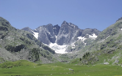
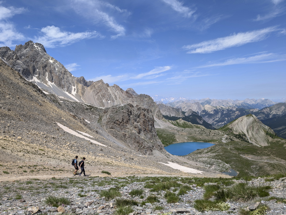
- Section 3 (Landry to Modane/Fourneaux): The most technically demanding section. Col de l'Iseran (2770m, Stage 11) is the highest point on the standard route; a variant crosses Col des Fours at 2976m. Stages 12 and 13 are both over 25km with substantial ascent. The GR55 high-level alternative through the Vanoise is spectacular but requires careful snow assessment.
- Section 4 (Modane/Fourneaux to Ceillac): The route passes through the Vallée Étroite (formerly Italian territory) and Stage 17 arrives in Briançon, the largest town on the entire route and an excellent place to take a rest day.
- Section 5 (Ceillac to St-Dalmas): The Mercantour wilderness. Stage 24 (Auron to Refuge de Longon, 27km, 11hr 15min) is the most demanding stage in this section and should not be underestimated. Accommodation between stages can be sparse.
- Section 6 (St-Dalmas to Nice or Menton): The Mediterranean draws closer. The main GR5 to Nice involves some exposed, arid hill country; the GR52 alternative to Menton is longer and significantly rougher, with high-level navigation through the Vallée des Merveilles.
Navigation is generally reliable, with consistent red-and-white waymarking throughout. Watch for: other GR routes sharing the same marks, faded markers that have been painted over but not fully removed, and sections in national parks where markers have been chiselled off or reduced in size.
Can I walk a shorter section of the GR5 – Through the French Alps?
The GR5 is designed to be walked in sections and public transport to at least a dozen points along the route is good. The guidebook identifies bus and train links throughout. Particularly useful break points include:
- Les Houches (end of Stage 5): Excellent transport links via Chamonix. A natural one-week section from Lac Léman, with the option to spend additional days exploring the Chamonix valley.
- Landry (end of Stage 8): Railway station. A practical break point before the demanding Vanoise sections.
- Modane/Fourneaux (end of Stage 14): Excellent transport links, described in the guidebook as one of the best places to break the journey when walking in sections.
- Briançon (Stage 17): Largest town on the route, with train connections to Gap and Grenoble. Rich in military history and well worth a rest day.
- St-Étienne-de-Tinée and Auron (end of Stage 23): Regular and very cheap daily buses to and from Nice, making these ideal start or finish points for section walkers.
Walkers who prefer shorter daily distances should base their planning on the 40-day schedule, where daily averages drop to 15km and 5hr 20min.
Should I take the main GR5 to Nice or the GR52 to Menton?
The choice arises at St-Dalmas, near the end of the trek. Both routes are described in full in the guidebook, with maps.
The main GR5 to Nice (Stages 26–28, 3 days) follows an elevated crest through the hilltop villages of Utelle and Aspremont before the final descent to the city. It is the more direct option, ending in a major city with excellent transport connections.
The GR52 to Garavan/Menton (6 stages, roughly a week) takes a longer, more rugged route northwards into the mountains before swinging south through the Vallée des Merveilles, famous for its thousands of Bronze Age rock engravings. The final descent lands on the Mediterranean at Menton. It is a significantly more demanding option, with some of the roughest and most committing terrain on the entire GR5. Those with the time and energy will find it a more spectacular finish.
Which direction should I walk the GR5 – Through the French Alps?
Almost all walkers follow the route north to south, from Lac Léman to the Mediterranean, and this is the direction described in the guidebook. Starting in the north means working steadily southward toward warmer, more Mediterranean conditions, with the sense of progress building throughout the trek.
Walking south to north is possible: the waymarks and signposts work just as well in reverse, and the practical services are the same. However, you will meet very few other GR5 walkers going the same direction, which affects the sociability of communal refuge evenings that many walkers consider one of the pleasures of the route.
When is the best time to walk the GR5 – Through the French Alps?
The GR5 through the French Alps is primarily a summer trek, and the timing matters more here than on either of the two northern volumes.
- Mid-June to early July: Possible, but snow often lies deep on some high cols. The start of the 2024 summer season, for example, saw many high passes buried under unusually heavy snowfall. Check conditions carefully and be prepared to use the GR5E low-level alternative through the Vanoise if the high cols are blocked.
- Mid-July to mid-August: The main French holiday period and generally the best weather. Competition for beds is at its peak; booking a day or two ahead is advisable. Most refuges are fully open.
- Late August to mid-September: An excellent time to walk. Quieter than peak season, weather usually remains good, and most refuges and gîtes are still open.
- October onwards: Not recommended. Early winter weather can arrive quickly in the Alps, and many refuges close after mid-September.
A typical Alpine summer day starts cool and clear, warms through the morning, and builds to afternoon cloud that can produce rain or storms. Most experienced Alpine walkers start early and finish early. Check the météo at refuges and tourist information offices each morning.
What is it like to walk through the Alpine national parks?
The GR5 through the French Alps passes through or alongside three national parks, each with a distinct character.
The Parc National de la Vanoise (Section 3) is where the route reaches its highest and most committing terrain. The core zone prohibits camping (other than at designated bivouac spots) and dogs must be kept on leads. Wildlife is strictly protected, and the park is home to large herds of bouquetin (Alpine ibex) and chamois that have become noticeably less wary of humans within its boundaries. The GR55 high-level alternative runs through the heart of the Vanoise and is considered one of the most beautiful stretches of the entire GR5.
The Parc Naturel Régional du Queyras (Section 4) has a gentler character: traditional woodworking villages, mixed forest, and the well-tended approaches to Ceillac. It is the most culturally interesting of the three parks rather than the wildest.
The Parc National du Mercantour (Section 5 and the GR52) is the most remote. Wildlife is given special protection, infrastructure is sparse, and walkers must rely on tiny hamlets for food and shelter across some long, demanding stages. The Vallée des Merveilles (GR52) contains thousands of Bronze Age engravings, a UNESCO candidate site of exceptional archaeological importance. Dogs are not permitted in the core zone.
What accommodation is available on the GR5 – Through the French Alps?
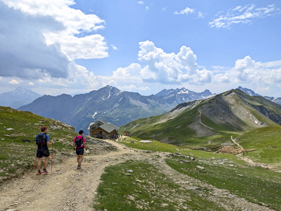
Accommodation along the route ranges from full-service hotels in towns like Chamonix, Briançon and Auron to basic refuges with communal dormitories in the remotest mountain stages. Anyone walking the whole route using a single type of accommodation will find it impossible: the mix is unavoidable.
Refuges are the backbone of the route. Most are run by the Club Alpin Français or private families, operate as restaurants during the day, and serve communal evening meals. Sleeping is in mixed dormitories; bunks have mattresses and duvets but you need your own sheets or a sleeping bag liner. Check current refuge details at www.refuges.info.
Gîtes d'étape offer similar accommodation to refuges but often with smaller dormitories and more facilities. See www.gites-refuges.com for specific details along the route.
Demi-pension (dinner, bed and breakfast) costs around €60 per person per night in a refuge and €75 in a gîte d'étape. A single person in a hotel might pay well over €100. Budget backpackers camping throughout can manage on as little as €30 per day; walkers using a mix of refuges and the occasional hotel should budget around €150 per day.
Most refuges now accept card payment, but remote locations may require cash. Carry both.
Advance booking is advisable during peak season (mid-July to mid-August), particularly around popular stages near Chamonix. Outside peak season, booking a day or two ahead as you walk is sufficient. Refuge staff will usually book ahead for you; most places can also be booked online.
A full accommodation list by stage is provided in Appendix A of the guidebook.
Getting to St-Gingolph or Thonon-les-Bains, and leaving from Nice or Menton
Getting to the start: The nearest major airports are Geneva and Nice. From Geneva, St-Gingolph is easily reached by train (around 1.5 hours). Thonon-les-Bains, the alternative starting point for the two-day Stage 1a/1b variant, is also well served from Geneva. Travel between the airport and the start costs roughly €10–€20 by bus or train. Walkers from London can travel by Eurostar and TGV, with a change at Geneva or Lyon.
Leaving from Nice or Menton: Both are major transport hubs with airports, rail connections, and onward services to all parts of France and beyond. Nice Airport has direct flights to many UK and European cities.
Along the route: Useful bus and train services are noted throughout the guidebook's stage descriptions. Key intermediate access points include Les Houches (Chamonix valley rail connections), Landry (railway station), Modane/Fourneaux (excellent transport links), Briançon (rail connections to Gap and Grenoble), and St-Étienne-de-Tinée/Auron (daily buses to Nice). Grenoble airport is also worth considering for walkers joining or leaving the route around Modane or Briançon.
What are the highlights of the GR5 – Through the French Alps?
- Mont Blanc views (Sections 1 and 2): The route approaches within clear sight of the highest peak in the Alps. The panorama from the flanks of Le Brévent is one of the signature moments of the whole GR5.
- Col du Bonhomme and the Beaufortain (Stage 7): Lush green high-alpine pastures and the satisfying rhythm of the first big col crossing.
- The Vanoise high route via GR55: Through the heart of the national park, with bouquetin grazing within metres of the path and views of glacier-draped peaks in every direction.
- Col de l'Iseran (2770m, Stage 11): The highest point on the standard route; the road over the col is also the highest paved road in the Alps.
- Balcon paths above the Arc valley (Stages 12–13): Traversing the flanks of the mountains with vast views across the valley far below.
- Vallée Étroite (Stage 16): Signs in Italian, food cooked in the Italian style, a valley that was part of Italy until after World War II.
- Briançon (Stage 17): A UNESCO-listed Vauban fortified city, the highest city in Europe, with outstanding military architecture and excellent transport links.
- Parc du Queyras (Stages 18–19): Traditional woodworking villages and wild, uncrowded terrain.
- Pas de la Cavale (Section 5): Particularly grand mountain scenery on the approach to the Mercantour.
- First sight of the Mediterranean (Section 5): On the sprawling slopes of Mont Mounier, the distant sheen of the sea catches the eye for the first time.
- Vallée des Merveilles (GR52): Bronze Age rock engravings in a high, remote valley. One of the most extraordinary archaeological landscapes in France.
- Arrival at Nice or Menton: Walking out of the mountains and onto the Mediterranean shore, the full length of the Alps behind you, is simply one of the great feelings in walking.
Plan your walk with the Cicerone guidebook
The GR5 Trail – Through the French Alps by Paddy Dillon contains everything you need to plan and complete the route from Lake Geneva to the Mediterranean.
- 28 main stage descriptions across six sections, each with full ascent, descent and timing data, plus complete descriptions of the GR55, GR5E and GR52 variant routes
- Three scheduling options presented on the overview profile: 28-day (direct), 31-day, and 40-day (leisurely, averaging 15km / 5hr 20min per day)
- 1:100,000 daily route maps covering the entire GR5 and all variants, with facilities (accommodation, water, services) marked for at-a-glance planning
- Route profiles for each stage, showing all ascents and descents
- Section introductory maps showing towns and potential transport links off-route
- Downloadable GPX files for the complete route
- Appendix A: Full accommodation list by stage, including refuges, gîtes d'étape, hotels and chambres d'hôtes
- Appendix B: Basic French vocabulary for the GR5
Available as a printed guidebook (£18.95) or digital eBook (£18.95).
The GR5 Trail - Through the French Alps
From Lake Geneva to Nice, including GR52 to Menton
£18.95
Discover the GR5 trail from Lac Leman (Lake Geneva) through the French Alps to the Mediterranean at Nice or Menton. The 600km (373 mile) trek takes 1 month to walk and includes all the main variant routes as it passes Mont Blanc, then through the Vanoise, Queyras and Mercantour National Parks. Includes accommodation guide, profiles and maps.
More informationAbout Paddy Dillon, guidebook author:
Paddy Dillon is a prolific walker and guidebook writer, with over 100 guidebooks to his name and contributions to 40 other titles. He has written for several outdoor magazines and other publications and has appeared on radio and television. Paddy uses a tablet computer to write as he walks. His descriptions are therefore precise, having been written at the very point at which the reader uses them. Paddy is an indefatigable long-distance walker who has walked all of Britain's National Trails and several European trails. He has also walked in Nepal, China, Korea and the Rocky Mountains of Canada and the US.