The Karwendel Mountains of Austria

Only an hour’s drive from Munich or Innsbruck, the Karwendel Mountains, on the border of Germany and Austria, are often overlooked thanks to their proximity to motorways and urban centres. But this nearness to civilisation is quite deceptive: tucked away and not directly accessible by major roads, these mountains are far wilder and more rugged than one would suspect from a casual glance at the map.
How do you get there?
The nearest airports are Munich and Innsbruck. Both have flights to and from most European destinations, including the UK. Buses and trains can be used to travel from both destinations to the Karwendel Mountains. More information can be found on the Karwendel website.
When is the best time to go?
The best time to go is May/June and September/October. These months provide the most stable temperatures and conditions, and the alpine meadows will be in full bloom. Huts and other tourist amenities will also be open. The winter months in the Karewendel National Park are more suited to winter sports.
Where are the visitor centres?
These are at Hinterriß, Scharnitz and Halltal.
The crumbly terrain of the ‘Limestone Alps’, as they are sometimes called, is of limited appeal to developers of ski resorts. Fortunately, their unique features were recognised by early environmentalists and placed under protection as early as 1928. They are now safeguarded as a transnational ‘Alpenpark’ nature reserve, which extends across both sides of the border. Access is only possible at a few points around the edges via small roads. Lack of access and an almost total absence of cable cars and ski lifts have saved the area’s wilderness.
Nothing had quite prepared me for the intense eyes I found myself looking into as I popped my nose over the last brow of a juniper-sprinkled mountain meadow at 1800m. But it was the rather unrelenting look of the horns that stopped me in my tracks: to put it bluntly, I was stunned. The ibex seemed less flabbergasted by the unexpected encounter. He fixed my gaze and simply stood there, fully conscious of his advantage, waiting to see what kind of human had stumbled on his pad. Perhaps naively, I hadn’t considered the possibility of running into wildlife so close to civilisation, much less horned wildlife that did not run away at the sight of a human.
The Karwendel Alpenpark
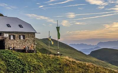
The only permanent settlement within the boundaries of the Alpenpark is the tiny village of Hinterriß, on the northern side, but the mountains are more frequently accessed either from Mittenwald, the most traditional town in the Bavarian Alps, or from the even tinier village of Scharnitz, just over the border in Austria, where the Isar River bends to flow north to Munich. From Scharnitz several valleys run up into the mountains, among them the Isar Valley, leading to the source of the Isar.
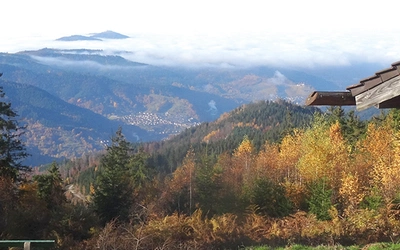
The other main point of access is from the resort town of Pertisau. Situated on the western shore of Lake Achensee, Pertisau was one of the first ‘holiday villages’ in Austria. Before the growth of the tourist industry, Habsburgian Kings and nobles favoured the area for hunting. Their elaborate lodges have since been replaced with prestigious hotels that mostly pander to ‘wellness tourists’ and golfers.
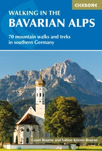
Walking in the Bavarian Alps
70 mountain walks and treks in southern Germany
£18.95
Guidebook to mountain walks and treks in the Bavarian Alps, on the border of Germany and Austria, between Lake Constance and Berchtesgaden. Accessible from Munich, Salzburg and Innsbruck, these 70 routes range from half-day walks to 3-day hut-to-hut treks. Highlights include the Konigssee and Breitach, Partnach and Hollental gorges.
More informationBut just beyond the village, nature takes over. A couple of toll roads run into the reserve, but they end where the mountains block the way. The heads of the valleys are punctuated by what used to be summer mountain farms (‘almen’). Today, they mostly farm tourists and hungry walkers in need of sustenance.
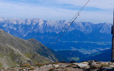
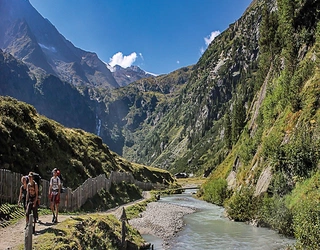
Beyond these almen, the trails, leading steeply up through the craggy mountains, are pretty quiet and for walkers only. The lower flanks are mostly covered in pines and fir, but scree fields are scattered everywhere, and unexpected fissures seemingly tear the rocks apart. The ridges are often narrow, requiring the sure-footedness of a mountain goat to walk safely across their razor’s edges, and some of the peaks can only be reached by scrambling. Up here, in these inaccessible places, the wildlife has found a refuge. Not just ibex, but also mountain goats, marmots, the European viper and, above all, golden eagles make their homes on the precarious ledges of the sheer rock walls.
Trails in the Karwendel
Although peaks in the Karwendel barely top 2500m and are thus not particularly superlative compared to other Alpine mountain chains, when faced with this surprisingly difficult and often spectacular scenery, one quickly realises that size is not all that matters, not even when it comes to mountains. Walking is by far the best way to explore this rugged terrain. There are many short trails available right from tourist centres such as Pertisau, Mittenwald, or Scharnitz, but since access to the heart of the region is so difficult, the best way to really get into the thick of it is to explore the region on a multistage trek. There are a several options:
The Munich–Venice Trail sections 5, 6 and 7
Covering a distance of 550km and climbing 20,000 meters, the Munich–Venice Trail is a very demanding route. Three of its stages run through the Karwendel Mountains. This is a challenging walk, especially the middle part, which traverses some of the most difficult terrain in the region and includes a section of pretty serious scrambling that is only suitable for experienced walkers and mountaineers. The starting point is Vorderriss in Germany, and the endpoint is in Hall, in the Inn Valley.
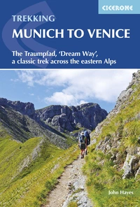
Trekking Munich to Venice
The Traumpfad, 'Dream Way', a classic trek across the eastern Alps
£18.95
Guidebook to Der Traumpfad, 'Dream Way', through Germany and Italy, 570km from Munich to Venice across some of the best scenery in the Alps. Split into 30 stages, the guide also describes 5 alternate stages and a day's via ferrata in the Dolomites. Includes full information and accommodation lists needed for the trek.
More informationKarwendel Crossing
This tour is not quite as hard. It crosses the mountains from Mittenwald to Pertisau via a 70km route, divided into six day-long sections. With a total of 5037m to climb, it is still not without challenges. Although this tour is rated as ‘moderate’ it is worth remembering that grading is done by Austrian mountain goats, so it may need adjusting to your own personal fitness level.
Karwendel Family Tour
This is an easy variant which skips the more demanding peaks and only includes modest ascends that require no mountain goat abilities. The tour crosses the range from east to west on an easy 5 day route of 40km, starting at Gramaialm near Pertisau and ending with a long, gradual descent along the Karwendelstream down to Scharnitz. Individual stages are kept short, between 5–16km (the last one is the longest), to make it more child-friendly, but these can easily be adjusted according to ability.
All tours are fantastically scenic, but remember: these are limestone mountains, and there can be a lot of loose gravel on the trails that make walking difficult, especially downhill. Walking sticks are highly recommended, and if you are not sure-footed, or suffer from vertigo, it may be better to forego the more challenging routes. The Austrian grading system marks easy trails in blue, moderate ones in red and difficult ones in black.
Further information