Walking in the Algarve: a complete planning guide
Portugal's southernmost region is far more than its famous sandy beaches suggest. The Algarve offers 32 graded day walks ranging from 4 to 18km (2 to 11 miles), taking walkers from jagged Atlantic clifftops and hidden coves along the south coast to the forested, mist-touched slopes of the Serra de Monchique and the wild, wind-scoured shores of the Costa Vicentina. Walks take between 1 and 6 hours, suited to all abilities, and the mild climate makes this one of Europe's most rewarding destinations for a winter or spring walking break. This article covers everything you need to plan your Algarve walking holiday, based on the Cicerone guidebook by Nike Werstroh and Jacint Mig. (Last updated: June 2026 · Guidebook edition: 3rd edition, November 2025)
Walking in the Algarve, quick facts:
- Location: Algarve, southern Portugal
- Total routes: 32 graded day walks
- Distance range: 4 to 18km (2 to 11 miles) per walk
- Typical duration: 1 to 6 hours
- Difficulty: Grades 1 to 3 (Grade 1 = easy/short; Grade 2 = moderate; Grade 3 = longer or more difficult terrain)
- Terrain: Coastal clifftop paths, inland hill trails, forest tracks, river valleys and traditional village routes
- Highest point: Fóia, Serra de Monchique (902m)
- Navigation: Route descriptions with 1:25,000 and 1:50,000 maps; downloadable GPX files included
- Best season: October to May; spring (February to April) is ideal for wildflowers and orchids
- Guidebook: Walking in the Algarve by Nike Werstroh and Jacint Mig, 3rd edition
Walking in the Algarve
32 walks in the south of Portugal including Serra de Monchique and Costa Vicentina
£17.95
Guidebook to 32 day walks in the Algarve, Portugal's southernmost region. The selected routes offer both coastal and inland options, including the Serra de Monchique and Costa Vicentina, the south and west coasts, the central region and East Algarve. The Algarve benefits from a mild climate, fine scenery and easy transport access.
More informationWhat is Walking in the Algarve?
Walking in the Algarve is a Cicerone guidebook to 32 day walks across Portugal's southernmost region, covering four distinct areas: the eastern Algarve, the central region including the Serra de Monchique, the south coast from Albufeira to Sagres, and the wild Costa Vicentina to the west. Authors Nike Werstroh and Jacint Mig — who live in Guildford and have been walking and researching trails across Europe for many years — make a strong case that the Algarve deserves to be taken seriously as a walking destination, not just a sun-holiday one.
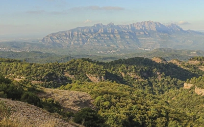
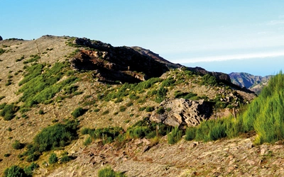
Walking is the best way to explore the Algarve's surprisingly diverse scenery. There are no high mountains, but there is genuine variety: the narrow coastal path threading its way above sea stacks and sinkholes cut by the Atlantic, the forested hillsides of the Monchique range where cork oak and eucalyptus give way to tranquil villages, and the barrocal, the limestone transition zone between hills and coast, characterised by almond, carob and olive groves. The region's geological complexity — from Paleozoic greywacke on the wild west coast to Jurassic limestone on the Sagres Peninsula — has produced a coastline of arches, coves and sculpted cliffs that rewards close exploration on foot.
The Algarve also carries five centuries of Moorish history, which you can read in its place names, its architecture and even its vocabulary. Many of the trails pass ruined forts, old noras (traditional wells) and, near Mealha, a megalithic burial site dating back to the 3rd or 4th millennium BC. This guidebook is as much about understanding a landscape as walking through it.
This planning guide answers the most common questions walkers have before setting out. For complete walk descriptions and mapping, see the Cicerone Walking in the Algarve guidebook.
The 32 walks at a glance
The guidebook divides its 32 routes into four geographical areas, each with its own character: the eastern Algarve, the central region centred on the Serra de Monchique, the south coast from Albufeira to Sagres, and the wild Costa Vicentina to the west. Eight routes that illustrate the breadth of the guidebook are highlighted below; full distances and timings for all 32 walks are in Appendix A of the guidebook.
| Walk | Area | Distance | Why it stands out |
|---|---|---|---|
| Fonte Benémola | Eastern Algarve | 4km | Spring-fed riverside trail through lush riparian vegetation; one of the Algarve's most scenic inland walks |
| Rocha da Pena | Eastern Algarve | 7.5km | Limestone massif with far-reaching views; rich in orchids and wildflowers in spring |
| Monchique–Fóia loop | Central region | 13km | Reaches the Algarve's highest point (902m) through cork oak forest and traditional villages |
| Caldas de Monchique to Picota and to Monchique | Central region | 12km | Links the spa town of Caldas with the Picota summit; good birdwatching throughout |
| Seven Hanging Valleys (Praia do Vale do Olival to Praia da Marinha) | South coast | 9.5km | The Algarve's most celebrated clifftop walk, above sea stacks, arches and sculpted limestone coves |
| Salema to Sagres | South coast | 18km | The longest route in the book (18km) and the most dramatic section of the Rota Vicentina coastal trail |
| Carrapateira circular | Costa Vicentina | 12km | Rugged, wind-battered coastal trail with wooden viewpoints above crashing waves; a clifftop archaeological site on the return leg back to Carrapateira |
| Fortaleza da Arrifana circular | Costa Vicentina | 10.5km | Ruined clifftop fortress with stork nests on the coastal cliffs; the only place in Europe where white storks breed on sea cliffs |

Who is Walking in the Algarve suitable for?
The routes in this guidebook are graded 1 to 3 and cover the full range from gentle strolls to longer half-day walks. Most walkers with reasonable fitness and a head for uneven ground will find much to enjoy across all four sections.
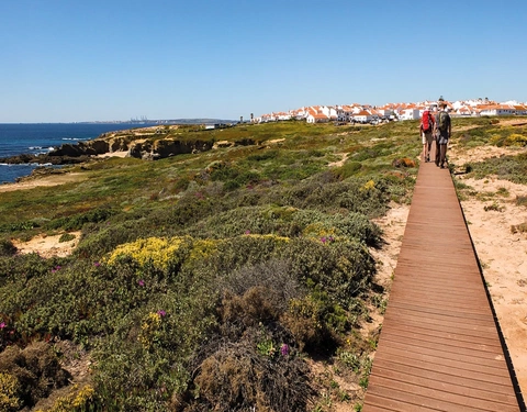
Grade 1 walks are short, easy and involve little significant ascent or descent. They suit families, less experienced walkers, or anyone who wants a relaxed few hours outdoors. The Alvor boardwalk (Walk 22) and the Ludo Trail (Walk 2) are examples. Note that as of April 2026, Walk 2 is no longer circular as the path near the salt storage has been fenced off; the Ria Formosa Natural Park remains worth visiting but walkers should expect to retrace their steps from one of the bird hides.
Grade 2 walks are moderate: medium to longer in length but on mostly easy terrain. The majority of the coastal and inland routes fall into this category.
Grade 3 walks are longer or involve more difficult terrain. The mountain routes around Fóia and Picota in the Serra de Monchique sit here, as does the 18km Salema to Sagres coastal section (Walk 25), which is the longest route in the book. On coastal walks, the grading assumes you follow the main path; if you explore every outcrop and promontory (which the guidebook actively encourages), expect to add significant time.
Dogs and young children may find some of the clifftop coastal paths demanding, where narrow tracks run close to drops. The guidebook notes that strong winds on the west coast can make the Costa Vicentina walks more physically demanding than the grade alone suggests.
How difficult are the walks in the Algarve?
Navigation is generally straightforward. Most routes use waymarked PR trails (marked with yellow/red signs) or sections of the long-distance Rota Vicentina (green/blue signs) and Via Algarviana (red/white signs). GPS co-ordinates are provided for all start points, and downloadable GPX files are available for every walk. The guidebook notes that some routes briefly follow paths marked with a cross (the waymarking convention for "wrong direction"), and flags this clearly in the relevant walk descriptions.
The trickiest navigation is in the eastern Algarve, where directional signs sometimes appear well ahead of the actual junction. In the Monchique hills, cloud and wind can reduce visibility and make the terrain feel harder than the grade suggests. Comfortable hiking boots, sufficient water and sun protection are essential across all areas; a warm layer is recommended for the Monchique range and west coast, particularly in winter and spring.
There are no dedicated walking maps commercially available for the Algarve. The guidebook's 1:25,000 and 1:50,000 maps, combined with GPX files and apps such as Maps.me or Mapy.cz, provide adequate navigation support for all the described routes.
When is the best time to walk in the Algarve?
The Algarve's walking season runs from October to May. The summer months (June to August) are generally too hot for comfortable walking on exposed trails, though early morning starts are possible for those determined to continue.
- February to April is the most rewarding period. Spring arrives early, sometimes as early as January on the south coast, with almond trees in blossom from late January. Orchids appear from February; March and April see the greatest variety of wildflower species including bee, green-winged, pyramidal and naked man orchids. Temperatures are warm but not oppressive.
- October and November offer a genuine shoulder season alternative: fewer visitors, pleasant temperatures, and the first autumn rains greening up the inland hills. September can still deliver beach weather, and the coastal paths are walkable, though carry plenty of water.
- December and January are wetter and cooler, but the temperature remains pleasant for walking and the streams and valleys come alive after rain. The west coast and Monchique range will be colder and windier than the sheltered south coast.
- May and June can still be comfortable for shorter coastal walks and early-morning starts in the hills, though heat builds quickly.
Note that snack bars and beach restaurants along the coastal paths are often only open during the main season (May to October). Plan refreshment stops accordingly in the off-season.

Are there good wildflower walks in the Algarve?
The Algarve is one of southern Europe's best destinations for spring wildflowers, and the guidebook gives this serious attention. Orchids are the headline act: the region supports numerous species, with the first appearing as early as late January or early February and some still flowering into June. March and April are the peak months for variety.
Species to look out for on the walks include the Bee orchid (one of the earliest to flower), the Green-winged orchid (April to May), the Pyramidal orchid (April to May, on meadows and cliff-tops), and the Naked man orchid, which can be seen along tracks and near the coast on Walk 24 (Luz to Salema). The Sawfly orchid can be spotted in March in the Barão de São João forest on Walk 16.
Beyond orchids, almond blossom whitens the countryside from late January — the introduction notes it resembles a dusting of snow across the hillsides. White and pink rock roses flower in spring, and wildflowers carpet the meadows and cliff-tops across the barrocal and the coastal paths. The Monchique range and the eastern Algarve trails offer the most rewarding inland wildflower walking; the cliff-top routes of the south coast add coastal species to the mix.
For the best combination of orchids, blossom and comfortable temperatures, plan a visit in late February to early April.
What accommodation is available in the Algarve?
Accommodation is plentiful along the south coast and in the major resort towns, with hotels, guesthouses and self-catering apartments readily available in Faro, Lagos, Albufeira, Carvoeiro, Portimão and Sagres. Booking well ahead is advisable for spring visits (March to May), when the Algarve is popular with both walkers and general tourists.
In the Monchique range and inland villages, options are fewer but available. The guidebook recommends using trusted booking websites and notes that Airbnb offers a wide selection of private rentals both coastal and inland.
For walkers tackling Walks 23–26 as a multi-day coastal trek from Lagos to Cabo de São Vicente, accommodation can be found in Lagos, Luz, Salema and Sagres at the end of each day's walking. Sagres to Cabo de São Vicente (Walk 26) is a shorter section and can be combined with the previous day's stage. The one route where this matters most is Walk 25 (Salema to Sagres, 18km): it is the longest walk in the book, and retracing your steps is not a realistic option at this distance. Check bus timetables in advance or arrange a taxi.
For campsite information, the guidebook directs walkers to https://www.camping.info/en/country/portugal/algarve.
How do I get to and around the Algarve for walking?
Getting there: Fly to Faro, which has direct connections from many UK and European airports. Carriers including easyJet, Ryanair, Jet2, British Airways, TAP Air Portugal and TUI all serve Faro from UK airports. Alternatively, fly to Lisbon and take a train or coach south; see www.portugaltrains.com and www.flixbus.co.uk.
By car: Hiring a car is the most practical option for accessing the full range of routes in this guidebook. Most trailheads have parking, and car hire is available at Faro airport and in the major towns. Book online in advance for better rates; companies based near the airport (rather than at it) can offer good value and run a shuttle service. The A22 motorway, which runs the length of the coast, was previously a toll road but has been free since January 2025.
By bus: A reasonable bus service connects the coastal towns, but inland villages can be harder to reach. The guidebook strongly recommends checking local timetables before planning any walk that relies on bus access, particularly Walk 25. Useful resources include:
- http://eva-bus.com
- https://www.vamusalgarve.pt/
- www.algarvebus.info (unofficial but frequently updated)
By taxi/rideshare: Taxis are available in most towns and Uber and Bolt operate across the region. If you plan to use a taxi to return to your start point after a linear walk, the guidebook recommends making arrangements before setting off.
By train: Trains connect the major towns but cannot reach most of the villages where the walks begin. Check www.cp.pt for inter-town connections.

Can I combine walks along the Algarve coast into a multi-day trek?
Yes. The south coast walks (Walks 23–26) follow the waymarked Rota Vicentina from Lagos to Cabo de São Vicente and are described in the guidebook as a natural 3 to 4-day coastal trek. Each stage ends in a town with accommodation. The progression is:
- Day 1: Lagos to Luz (Walk 23)
- Day 2: Luz to Salema (Walk 24)
- Day 3: Salema to Sagres (Walk 25)
- Day 4: Sagres to Cabo de São Vicente (Walk 26)
The Costa Vicentina walks (Walks 27–32) can also be linked with careful logistical planning, but they are primarily described as individual circular or linear day walks. The Rota Vicentina has recently been extended and waymarked south from Odeceixe all the way to Lagos, making the full coastal connection feasible for those who want a longer self-designed itinerary.
Similarly, the central south coast section between Albufeira and Ferragudo (Walks 17–20) can be combined into a full-day linear walk along the coast, with accommodation available in the coastal towns along the way.
What are the long-distance trails in the Algarve?
Two long-distance routes cross the Algarve and provide context for many of the day walks described in this guidebook.
The Via Algarviana (GR13) is a 300km trail running from Alcoutim in the east to Cabo de São Vicente in the west, completed in 2009. Waymarked with red/white signs, it was designed to take walkers through the full diversity of the Algarve's interior landscape. Several of the guidebook's walks use sections of it.
The Rota Vicentina covers the western coastal stretch. It includes two parallel routes: the Fishermen's Trail (closer to the coast) and the Historical Way (slightly inland), both running south from Santiago do Cacém and splitting at Odeceixe. The trail has since been extended and waymarked south to Lagos. Sections of the Rota Vicentina feature in Walks 23–32, and the green/blue waymarkers are described in detail in the guidebook's navigation notes.
Walking in the Algarve
32 walks in the south of Portugal including Serra de Monchique and Costa Vicentina
£17.95
Guidebook to 32 day walks in the Algarve, Portugal's southernmost region. The selected routes offer both coastal and inland options, including the Serra de Monchique and Costa Vicentina, the south and west coasts, the central region and East Algarve. The Algarve benefits from a mild climate, fine scenery and easy transport access.
More informationPlan your Algarve walks with the Cicerone guidebook
The Walking in the Algarve guidebook by Nike Werstroh and Jacint Mig (3rd edition, November 2025) includes:
- 32 graded day walks across four areas of the Algarve: eastern Algarve, central region, south coast and Costa Vicentina
- Route descriptions with 1:25,000 and 1:50,000 map extracts for every walk
- Downloadable GPX files for all routes
- Practical information on access, parking and public transport for each walk
- Notes on geology, history, plants (including orchids) and wildlife throughout
- A Portuguese–English glossary (Appendix B)
- A route summary table (Appendix A) with distances, ascents and walk times
- Useful contacts (Appendix C)
- Coverage of waymarking systems including the Rota Vicentina and Via Algarviana
- Guidance on seasons, getting there and accommodation
Available as a printed guidebook (£17.95) or digital eBook.
About Nike Werstroh and Jacint Mig, guidebook authors
Nike and Jacint met many years ago on a long coach journey as they both travelled into the unknown to build a new life in a different country. It wasn't long before they became inseparable. Travelling quickly emerged as their favourite activity and now wherever they go they try to find the best trails. They would love to share their passion for walking with others. Nike went to journalism school and Jacint is a keen photographer. Nike and Jacint live in Guildford and when they are not walking in one of their favourite mountain ranges somewhere in Europe, they enjoy exploring the diverse trails in the Surrey Hills close to their home. And when they are not out walking they offer a personalised travel planning service, details of which can be seen on Nike and Jacint's website at www.trailnotes.co.uk.