Walking in Tuscany: a complete planning guide
Glorious Tuscany is one of the world's most beautiful walking destinations. Gently rolling hills clothed with fields of golden wheat and scarlet poppies, winding lanes lined with pencil-straight cypress trees, inviting villas with views to picture-perfect hill towns of medieval and Renaissance splendour, UNESCO World Heritage Sites, and dense forests giving way to rugged Apennine ridges. Walking in Tuscany means all this — and the island of Elba, the Mediterranean coastline of the Maremma, and the challenging peaks of the Alpi Apuane into the bargain. The 43 routes in Gillian Price's guidebook range from leisurely strolls through Chianti vineyards and Etruscan sunken lanes to strenuous mountain walks in the Apennines and the Alps of Tuscany, organised across nine distinct areas and covering the region's full geographic variety. (Last updated: June 2026 · Guidebook edition: 4th edition, 2023)
Walking in Tuscany, quick facts:
- Location: Tuscany, central Italy
- Total routes: 43 graded day walks
- Distance range: 2.6km to 18km per walk
- Typical duration:1hr to 6hr 30min per walk
- Difficulty grades: Grade 1 (easy) to Grade 3 (strenuous)
- Terrain: Vineyard tracks, Etruscan ways, forest paths, coastal maquis, mountain ridges, ancient pilgrim routes, and medieval hill town streets
- Navigation: CAI red/white waymarks on most routes; topographic maps provided for each walk
- Best season: Spring (March to May) and autumn (September to October) for most areas; summer for the mountains; winter for the coast and lower walks
- Main bases: Florence, Siena, San Gimignano, Cortona, Lucca, Volterra, Montalcino, Montepulciano, Pitigliano, Portoferraio (Elba)
- Transport: Excellent public transport network throughout; almost all walks accessible by train or bus
- Guidebook:Walking in Tuscany by Gillian Price, 4th edition
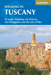
Walking in Tuscany
43 walks including Val d'Orcia, San Gimignano and the Isle of Elba
£17.95
Guidebook to 43 graded, mostly easy walks in Tuscany. Taking in the Renaissance splendour of Florence and Siena, the World Heritage scenery of Val d'Orcia and San Gimignano and the stunning island of Elba, the routes use historical pathways used by traders, pilgrims and armies, and include some brief, trouble-free climbs/descents.
More information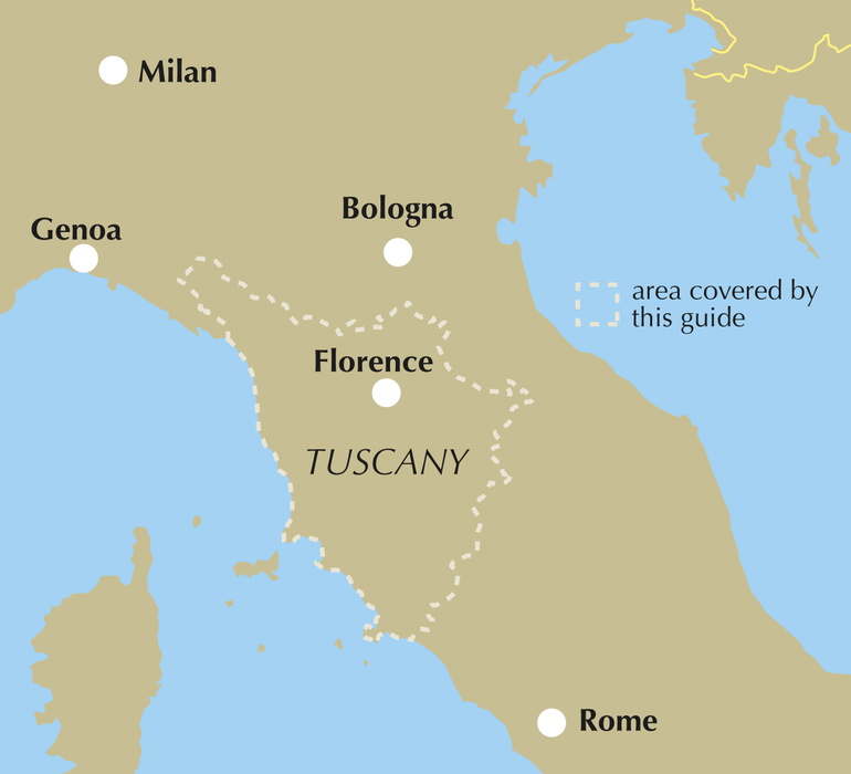
What is Walking in Tuscany?
Walking in Tuscany by Gillian Price is a day-walk collection covering one of Italy's most varied and rewarding walking regions. The 43 routes are organised across nine geographic chapters, each introducing a distinct area of Tuscany with its own character, history, and landscape: the environs of Florence; the foothills and high Apennines; the Alpi Apuane; the Pratomagno and Foreste Casentinesi; Chianti; west of Siena; the Crete and Val d'Orcia; Elba and the Tyrrhenian coast; and the Maremma coast and hinterland.
The walks follow historical pathways used by traders, pilgrims, armies, and travellers since ancient times, passing through landscapes associated with the Etruscans, the Romans, Saint Francis, Dante, Leonardo da Vinci, and Michelangelo. A breath of fresh air between the crowded art cities, the routes offer encounters with wild boar-hunted forests, vine-terraced hillsides, medieval walled towns, ancient Etruscan ways, and the pristine coast of the Maremma Natural Park.
Thanks to Tuscany's excellent public transport network, almost all walks in the guidebook are accessible by bus or train without a hire car. For complete route descriptions, sketch maps, and practical information for all 43 walks, see the Cicerone Walking in Tuscany guidebook.
The 43 walks at a glance
The guidebook organises the walks across nine geographic chapters. Routes are not graded uniformly across chapters — each area has its own mix of grades depending on the terrain.
| Area | Walks | Distance range | Time range |
|---|---|---|---|
| 1 The environs of Florence | 1-3 | 7-11km | 2hr 15min–3hr 20min |
| 2 The foothills and high Apennines | 4-9 | 4–16.5km | 1hr 30min–6hr 30min |
| 3 Alpi Apuane | 10–12 | 7.4–13km | 3hr 10min–5hr 30min |
| 4 Pratomagno and Foreste Casentinesi | 13–17 | 6.6–12km | 2hr 15min–4hr 40min |
| 5 Chianti | 18–21 | 5.5–16km | 1hr 30min–4hr |
| 6 West of Siena | 22–25 | 5.5–13.5km | 1hr 30min–4hr |
| 7 The Crete and Val d'Orcia | 26–32 | 2.6–17.2km | 1hr–4hr |
| 8 Elba and the Tyrrhenian coast | 33–38 | 3.2–18km | 1hr–4hr 15min |
| 9 The Maremma coast and hinterland | 39–43 | 7–12km | 2hr–2hr 45min |
1: The environs of Florence (Walks 1–3) introduces the hilly surroundings of the regional capital: the Fiesole to Settignano traverse above the city (Walk 1, 7.6km, Grade 1–2), a circuit of the Medici hunting estate at Artimino (Walk 2), and a walk through the hills of Vinci, home of Leonardo (Walk 3, 11km, Grade 2).
2: The foothills and high Apennines (Walks 4–9) covers fascinating territory where Pinocchio was created (Walk 4, Collodi) and then climbs into the rugged Apennine mountains. The standout is Walk 9, Monte Prado (16.5km, 1050m ascent, Grade 2, 6hr 30min) — the longest and most demanding in the book.
3: Alpi Apuane (Walks 10–12) presents three challenging routes in the rugged 'Alps of Tuscany', all at Grade 2–3 or Grade 3. Walk 10, the Monte Forato loop (13km, 850m ascent, 5hr 30min) is the most serious, passing through the famous natural arch. This chapter is best reserved for experienced hill walkers.
4: Pratomagno and the Foreste Casentinesi (Walks 13–17) tells of monks and spiritual retreats in age-old forests. Highlights include the great beech forest at Vallombrosa (Walk 13), the source of the Arno at Lago degli Idoli (Walk 14), and the ancient hermitage at Camaldoli (Walk 15). Cortona, one of Tuscany's finest hill towns, features in Walk 17.
5: Chianti (Walks 18–21) covers the world-famous wine country between Florence and Siena, with routes through vine-terraced hillsides, past wine estates, and between the medieval villages of Gaiole, Castellina, Radda, and Volpaia. The longest and most varied Chianti walk is the Castellina to Radda traverse (Walk 19, 16km, Grade 1–2).
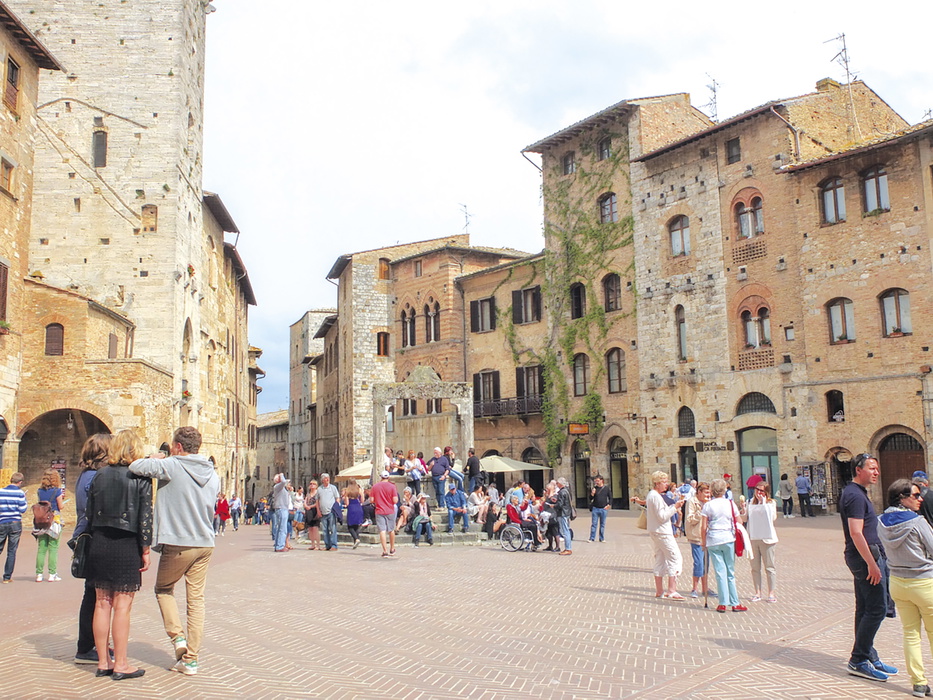
6: West of Siena (Walks 22–25) introduces the lesser-known gems of Volterra and Sovicille alongside the unmissable walled town of Monteriggioni (Walk 23) and San Gimignano of the fine towers (Walk 24, 8.8km, Grade 1). Walk 25, the descent from Volterra to the Saline di Volterra salt pans, is an unusual linear route.
7: The Crete and Val d'Orcia (Walks 26–32) reveals some of the most photogenic countryside in the world: the clay hills of the Crete, the cypress-lined roads of the Val d'Orcia (a UNESCO World Heritage landscape), and routes to Montalcino, Pienza, Montepulciano, and the extraordinary spa town of Bagno Vignoni. The shortest walk in the book is here: Radicofani (Walk 32, 2.6km, 1hr).
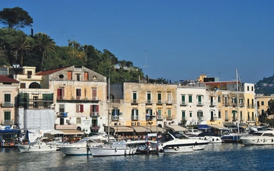
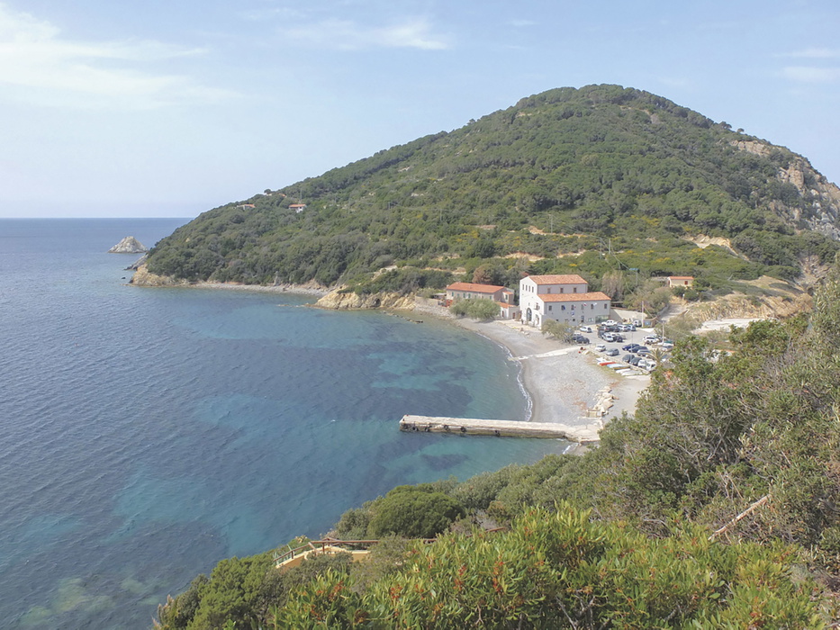
8: Elba and the Tyrrhenian coast (Walks 33–38) covers five routes on the stunning island of Elba — Napoleon's place of exile — and one on the adjacent mainland coast at Baratti and Populonia. The longest Elba walk is the Campiglia Marittima–Suvereto circuit (Walk 38, 18km, Grade 1–2), the longest in the book.
9: The Maremma coast and hinterland (Walks 39–43) embraces the pristine Maremma Natural Park and the quiet inland villages of the deep south, linked by ancient Etruscan sunken ways (vie cave). Walk 41, Feniglia (12km, negligible ascent, Grade 1), is a gentle coastal pinewood walk — one of the easiest and most distinctive in the collection.
Who is Walking in Tuscany suitable for?
Walking in Tuscany caters for a wide range of abilities. The majority of the 43 routes are at Grade 1–2 or Grade 2, requiring a reasonable level of fitness but no technical experience. Several short Grade 1 routes — including San Gimignano (Walk 24), Porto Azzurro on Elba (Walk 36, 3.2km), and Feniglia (Walk 41) — are ideal for beginners and families.
The Grade 2–3 and Grade 3 routes are concentrated in Chapter 3 (Alpi Apuane) and in the longer Apennine walks of Chapter 2. Walk 10 (Monte Forato loop, Grade 3) is the most demanding technically, with exposed terrain and 850m of ascent. Walk 9 (Monte Prado, 16.5km, 1050m ascent) is the most physically demanding in terms of distance and height gain.
The guidebook is particularly well suited to visitors based in one of Tuscany's main towns — Siena, Florence, Lucca, or Cortona — who want to walk a different route each day using public transport. Almost all walks are accessible by bus or train, and the guidebook gives detailed transport information for each route.
How difficult are the walks in Tuscany?
The guidebook uses a three-grade system. Grade 1 routes are easy, on clear tracks and paths, suitable for beginners. Grade 2 routes cross hill and mountain terrain with ups and downs, requiring a reasonable level of fitness. Grade 3 routes are strenuous, with some exposed stretches and possibly prolonged climbing; experience and extra care are recommended.
The majority of walks fall at Grade 1–2 or Grade 2. The Alpi Apuane chapter is the exception, with all three routes at Grade 2–3 or Grade 3; these are best approached by walkers with mountain experience. The Val d'Orcia and Maremma chapters contain the easiest walking, with mostly gentle terrain and minimal ascent.
When is the best time to walk in Tuscany?
Walking in Tuscany is feasible year-round, with different areas coming into their own in different seasons.
- Spring (March to May) is the finest time for most walks. Temperatures are perfect, the region is alive with wildflowers, and the grain fields of the Val d'Orcia and Crete are a brilliant mosaic of greens. Visitor numbers are manageable outside Easter and the long public holiday weekends.
- Summer (June to August) brings heat and haze at lower altitudes, making the coastal and valley walks less rewarding. The exception is the higher mountain areas — the Casentino forests, the Alpi Apuane, and the Apennines — where temperatures remain pleasant even in July and August. Mid-August (Ferragosto) is peak season: the island of Elba and the main art cities are extremely busy and prices are high.
- Autumn (September to October) is an excellent alternative to spring: fewer visitors, spectacular foliage in the forests, ripening grapes and olives, and comfortable walking temperatures. Daylight saving time extends into late October, giving long walking days.
- Winter (December to February) is ideal for the coastal walks and the lower-altitude routes of the Maremma and Val d'Orcia, where days can be brisk and clear with excellent visibility. Snow closes the higher mountain routes in the Apennines and Alpi Apuane. Daylight is limited to around 4.30pm in midwinter. November is best avoided due to persistent fog at lower altitudes.
What accommodation is available in Tuscany?
Tuscany has a huge range of excellent accommodation options. The guidebook provides short sections at the end of each chapter introduction suggesting suitable bases for each area, with details of transport links. Full accommodation listings are given in Appendix C, covering mid-range hotels and B&Bs, affittacamere (rooms to rent), and walkers' refuges convenient for the walks.
The best bases for access to the widest range of walks are Siena (for the Crete, Val d'Orcia, Chianti, and west of Siena chapters), Florence (for Chapter 1 and the Apennines), Lucca (for the Alpi Apuane and foothills), Cortona (for Chapter 4), and Portoferraio or Marciana Marina (for Elba).
Advance booking is generally not required except during Italian public holidays and mid-August, when the main art cities — Florence, Siena, San Gimignano — and the island of Elba are extremely busy. For a wider choice including agriturismo (farm stays), self-catering houses, and campsites, the tourist offices listed in Appendix D are the best resource.
How do I get to Tuscany?
The most convenient international airport is Pisa, with onward bus and train connections across the region. Bologna, Perugia, and Rome also serve Tuscany well, and the region is easily reached from other parts of Italy on high-speed Trenitalia and Italo trains on the strategic Rome–Florence and Milan–Florence lines.
Getting around Tuscany by public transport is both enjoyable and reliable. Almost all walks in the guidebook can be accessed by bus or train, and the guidebook gives transport details in the information box at the start of each walk. Regional trains run frequently and do not require advance booking. Local buses cover most of Tuscany, though some outlying villages may have no service on Sundays. Bus tickets should be purchased before boarding — at bus stations, news stands, or tobacconists — and stamped on board.
What are the highlights of walking in Tuscany?
- Chianti vineyards (Walks 18–21) are the quintessential Tuscany backdrop: vine-terraced hillsides, ancient stone farmhouses, and wine estates producing Brunello, Chianti Classico, and Vino Nobile. Walk 19 (Castellina to Radda, 16km) is the finest full-day route in this chapter.
- San Gimignano (Walk 24) is one of Tuscany's most visited medieval towns, its fourteen surviving towers visible from miles around. The 8.8km circuit into the surrounding vineyards offers the best views of the skyline and an escape from the crowds.
- The Val d'Orcia (Walks 26–32) is UNESCO World Heritage scenery at its most photogenic: the cypress-lined roads, clay hills, and honey-stone villages of the most painted landscape in Italy. Walk 27 (Montalcino to Sant'Antimo) combines a descent through olive groves with the extraordinary Romanesque abbey at the valley floor.
- Monte Forato (Walk 10) in the Alpi Apuane is named for the dramatic natural arch pierced through the mountain summit — one of the most distinctive geological features in the Apennines and the finest destination in the most challenging chapter.
- The island of Elba (Walks 33–38) is a world of its own: dramatic coastline, terraced vineyards, ancient iron mines, and a walking network that ranges from the gentle Porto Azzurro circuit (Walk 36, 3.2km) to the full mountain traverse from Marciana to Pomonte (Walk 35, 11km, Grade 2).
- The Maremma Natural Park (Walks 39–41) is one of Italy's best-preserved coastal parks, with walks through Mediterranean maquis, ancient Spanish watchtowers, and the famous Feniglia pinewood causeway between two lagoons.
- The Etruscan vie cave (Walks 42–43) around Pitigliano, Sovana, and Sorano are sunken roadways carved up to 20 metres deep into the volcanic tufa, connecting villages that have changed little since Etruscan times — the most atmospheric and unusual walking in the guidebook.
Plan your walk with the Cicerone guidebook
The Cicerone Walking in Tuscany guidebook by Gillian Price contains everything you need to plan and complete all 43 walks across the region.
- 43 day walks graded 1 to 3, organised across nine geographic chapters
- Topographic maps provided for each walk, with further commercial map references in each route description
- Full route descriptions for all 43 walks, with partial timings and waymark information
- Route summary table (Appendix A) listing all 43 walks by distance, ascent/descent, grade, and time
- Chapter introductions for each of the nine areas, covering the area's character, history, and practical information for walkers
- Accommodation listings (Appendix C) covering mid-range hotels, B&Bs, affittacamere, and walkers' refuges for each area
- Background sections covering Tuscany's plants and flowers, wildlife, food and wine, when to go, and transport
- Italian–English glossary (Appendix B) including timetable terminology and useful phrases
- Useful contacts and transport websites (Appendix D) for planning public transport to each walk
Available as a printed guidebook (£17.95) or digital eBook (£17.95).
Walking in Tuscany
43 walks including Val d'Orcia, San Gimignano and the Isle of Elba
£17.95
Guidebook to 43 graded, mostly easy walks in Tuscany. Taking in the Renaissance splendour of Florence and Siena, the World Heritage scenery of Val d'Orcia and San Gimignano and the stunning island of Elba, the routes use historical pathways used by traders, pilgrims and armies, and include some brief, trouble-free climbs/descents.
More informationAbout Gillian Price, guidebook author
Gillian Price has trekked throughout Asia and the Himalayas, but now lives in Venice and is exploring the mountains and flatter bits of Italy. Starting in the Italian Dolomites, Gillian has written outstanding Cicerone guides to walking all over Italy as well as Corsica and Corfu. An adamant promoter of public transport to minimise environmental impact, Gillian belongs to Mountain Wilderness and is an active member of the Venice branch of CAI, the Italian Alpine Club. Check her out at www.gillianprice.eu.