An introduction to the North Downs Way
Would you like to try an easy long-distance walk that showcases the best of the Surrey Hills and Kent Downs National Landscapes? The 130-mile (208km) North Downs Way may be the trail for you. Tracing the high chalk ridge of downland between Farnham and Dover, this National Trail has extensive views across the High Weald and the 'garden of England'. Take in the picturesque towns and villages along the way, as well as ancient sites perfect for anyone interested in the area's rich history.
The North Downs Way
National Trail from Farnham to Dover
£17.95
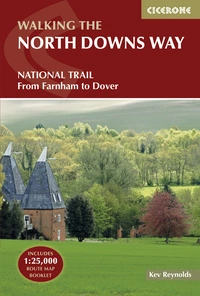
Guidebook to walking the North Downs Way National Trail, a 130 mile (208km) trail between Farnham and Dover, with an optional visit to Canterbury. Following the ancient Pilgrim's Way for much of the way, through pleasant countryside, this is one of the easier National Trails and the walk is described over 11 stages. With 1:25K OS map booklet.
More information
Where is it, and how long is the North Downs Way?
The North Downs Way is a National Trail that covers 130 miles (208km) between Farnham and Dover and passes through two Areas of Outstanding Natural Beauty - the Surrey Hills and the Kent Downs.
Why should you walk it?
There are many historic sites along the Way: Neolithic burial chambers, Roman roads and Norman churches, charming villages and tiny hamlets, England’s premier cathedral city, Canterbury, and its busiest ferry port at Dover. The trail also has literary connections with Jane Austen, Dickens, Joseph Conrad, George Meredith and JM Barrie – among others. Box Hill, a picnic location in Jane Austen's Emma, is part of the walk.
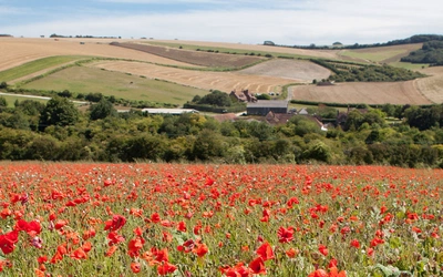
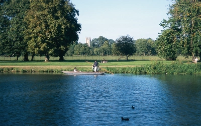
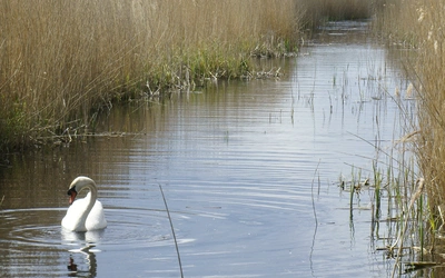
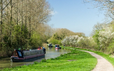
There are streams, rivers, ponds, and lakes along the route, as well as wildlife and a rich diversity of plant life. And, of course, walking through both the Surrey Hills and Kent Downs, there are contrasts of landscape that enrich each day’s walk and make a journey along the North Downs Way a truly memorable experience.
How difficult is the North Downs Way?
The North Downs Way is considered one of the easier long-distance National Trails. With distances between 12km and 22km per stage, the route is accessible for most walkers. It is adequately waymarked with arrows bearing an acorn symbol, well-maintained, and checked for obstructions. Plus, a map booklet is also available alongside the guidebook for easy navigation.
How is the North Downs Way different to the South Downs Way?
The North Downs Way National Trail offers the walker a very different experience from that on the South Downs Way. While the South Downs Way challenges with some steepish ascents and descents, the North Downs Way is much more gentle with fewer climbs, and where these are made, the gradients are generally much less demanding. There’s more habitation along the North Downs Way, but surprisingly, you meet far fewer walkers, and most of those you do meet are locals out exercising their dogs or enjoying a circular walk.
And what about the Pilgrims' Way?
The North Downs Way is really the child of the much older Pilgrims’ Way, which runs along the base of the Downs from Winchester to the shrine of St Thomas à Becket at Canterbury. That route dates back to the 12th century and begins in Winchester and ends in Canterbury. The North Downs Way continues to Dover and is now part of the E2 – a major European trail.
Where should you stay?
Along the route, a wide range of accommodations is available, from a handful of campsites, youth hostels, and camping barns (independent hostels) to more frequent private bed and breakfasts (B&Bs), country pubs, and a few high-priced hotels. The National Trail website allows you to download current accommodation details.
What is the best part of walking the North Downs Way?
There’s often a surprise view that stops you in your tracks, but one of the standout moments is seeing the famous white cliffs of Dover plunging to the surf hundreds of feet below the footpath.
What are the stages?
Our guidebook gives a detailed description of the official National Trail route, split into 11 stages with some optional variants. The stages are detailed in the route summary table below.
| North Downs Way Stages | Locations | Distance |
|---|---|---|
| 1 | Farnham to Guildford | 17.5km (11 miles) |
| 2 | Guildford to Mole Valley (A24) | 21km (13 miles) |
| 3 | Mole Valley to Merstham | 16km (10 miles) |
| 4 | Merstham to Westerham Hill | 20km (12.25 miles) |
| 5 | Westerham Hill to Wrotham | 22km (13.75 miles) |
| 6 | Wrotham to the Medway | 16.5km (10.5 miles) |
| 7 | The Medway to Detling | 16km (10 miles) |
| 8 | Detling to Harrietsham | 12km (7.5 miles) |
| 9 | Harrietsham to Boughton Lees | 17.5km (11 miles) |
| Option 1: Direct to Dover | - | - |
|---|---|---|
| 10 | Boughton Lees to Etchinghill | 21km (13 miles) |
| 11 | Etchinghill to Dover | 18.5km (11.5 miles) |
| Option 2: via Canterbury | - | - |
|---|---|---|
| 10a | Boughton Lees to Canterbury | 21km (13 miles) |
| 11a | Canterbury to Shepherdswell | 16.5km (10.5 miles) |
| 12a | Shepherdswell to Dover | 12.5km (8 miles) |