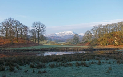
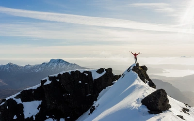
Winter mountain skills: techniques to measure slope angle

In summer the angle of a slope is of interest to the walker only in as far as how difficult it is to walk up, but in winter it can be a matter of life and death. International Mountain Leader Andy Hodges explains how to measure slope angles and therefore reduce the risk of an avalanche.
Avalanches can occur on slopes of almost any angle but there is a range on which most occur. Unfortunately, these tend to be prime skiing and mountain walking areas. The critical angles are considered to be between 30° and 45°.
Although these are 'prime' slopes it is vital to understand that the risk of an avalanche on any slope is affected by many elements. Avalanches can occur on slopes of much lower angles given a very heavy snow fall or other loading factors.
Travelling up, down or along these slopes is dangerous in avalanche conditions; deciding to travel beneath them is also an important consideration for the winter sports enthusiast.
Never say never
The UK’s deadliest avalanche took place in Lewes, Sussex, in 1836 when a slope gave way above a row of terraced houses. Of the 15 people buried, eight were killed. The Snowdrop Inn was built on the site and is named in memory of the incident.
How do you measure the angle?
There are a number of ways to measure slope angles but the most important can be identified reasonably easily.

1. Contours
A map gives the winter walker a good overview of the terrain and the spaces between them indicate the angle.
The Slope Angle Card from Shaven Raspberry is very popular and costs only £2. When placed on a map that has 10m contour intervals, it will give you the angle. Prime avalanche angles will be identified.
Advantages: small, cheap and easy to fit in a wallet, for example
Disadvantages: you need to know accurately where you are on the map. It works only on 1:25K and 1:50K maps with 10m contours (therefore it is possible to make large errors on another map).
Swiss mapping also identifies slopes over 30° on the winter versions of their maps.
2. Software
In some countries (mainly Alpine) mapping can be accessed online, which automatically identifies the slopes that are likely to suffer from avalanches. French Alps mapping can be accessed from My Trails. As previously mentioned, the Swiss winter maps include shading for 30° to 45° slopes.
Advantages: reasonably thorough and quick to access
Disadvantages: requires subscriptions and needs a charged device to access
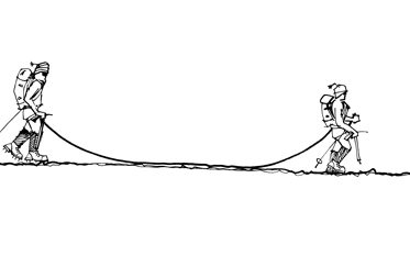
3. Trekking pole trigonometry
Trekking poles can be used to estimate slope angles. Place one pole in a vertical position and the other in a horizontal position to touch the slope. If the poles meet at full height then the slope is 45°; if they meet half way down the vertical pole then the angle is approximately 25°; if they meet at ¾ height then the angle is approximately 37°.
Advantages: fairly easy to use, accurate enough in most settings
Disadvantages: need two poles of the same length
4. Gizmos and gadgets
The modern world has no shortage of gadgets that will do the job for you.
Clinometer built into a compass: some upper-end compasses have a clinometer built into the bezel, which can be used most effectively if a pole is placed on the slope and the compass is placed on it.
Advantages: fairly easy to use, accurate, 'free' if the compass already has it built in
Disadvantages: breakable (not likely, though)

Apps: can be downloaded with a clinometer function (might be called 'angle measurer')
Smart Ruler Pro is one; it allows a slope to be measured while looking at it through the viewfinder/screen.
For a more accurate measurement, lie a pole along the fall line of the slope and put the device on the pole.
Advantages: fairly easy to use, accurate
Disadvantages: breakable, requires phone to be powered up
The Slope Angel: a new device, which is a valuable aid to slope assessment and incorporates an electronic clinometer and thermometer.
Turn it on, put a pole or ski on the slope along the fall line, lay Slope Angel on the pole/ski. Job done!
Advantages: easy to use, accurate, also gives temperatures
Disadvantages: breakable, quite expensive (about £20)
Key points
- The whole science of avalanche prediction is incredibly complex, as is the evolution and formation of snow crystals and forms
- Attending training in avalanche prediction and rescue are also 'non-negotiables' for any self-respecting winter mountain enthusiast
- The excellent Scottish Avalanche Information Service website and app will already be familiar to winter mountaineers venturing north of the border, while the Lake District Weather Line and Mountain Weather Information Service offer mountain-specific conditions and forecasts for most of the upland areas of the UK (not avalanche specific)