Flinders Island: a hiking jewel in the Bass Strait
If you’re looking for somewhere different, rarely visited, incredibly beautiful and with diverse walking opportunities, then Flinders Island should be ranked high on your list of places to go, says Sean Benz.
I can’t remember the last time I was blown away by a place but there’s no doubt that Flinders Island did just that on our first visit earlier this year.
Even most Australians would say: ‘Flinders Island, where’s that?’ It’s the largest of the 54 islands that make up the Furneaux Group, which stretch from the southern tip of the Victorian coastline at Wilson’s Promontory to the north-east coast of Tasmania. Over 12,000 years ago a land bridge connected mainland Australia with Tasmania; Aboriginal people crossed between the two before rising sea levels separated the land masses leaving a chain of islands stranded in Bass Strait. To the Tasmanian Aboriginal people, the islands are called Tayaritja and there are several sites of shell middens and stone artefacts scattered around the island testifying to their connection to the island.
The influence of colonialism is never far away, either; the Furneaux Islands where named after the British navigator Tobias Furneaux and Flinders Island was named after Matthew Flinders, who first explored the islands in 1778. Evidence of the dark side of colonialism exists as well; Aboriginal people were brought to Wybalenna in the early 1800s from Tasmania for resettlement and over a 10-year period more than 150 people died due to the poor conditions they were forced to live in. There is a chapel and graveyard at Wybaleena, although there is little reference to the 100 aboriginal people buried in the area.
True wilderness
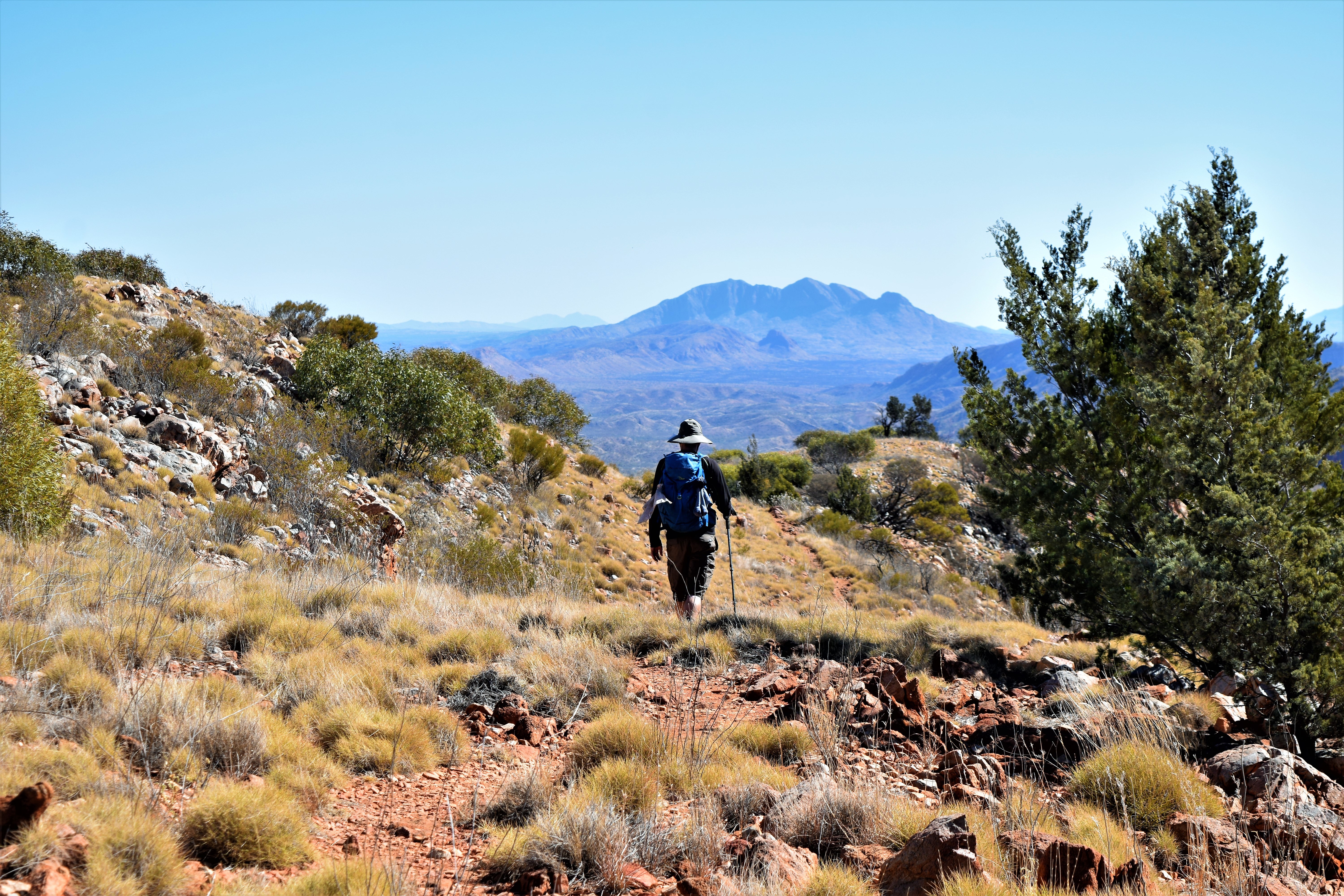
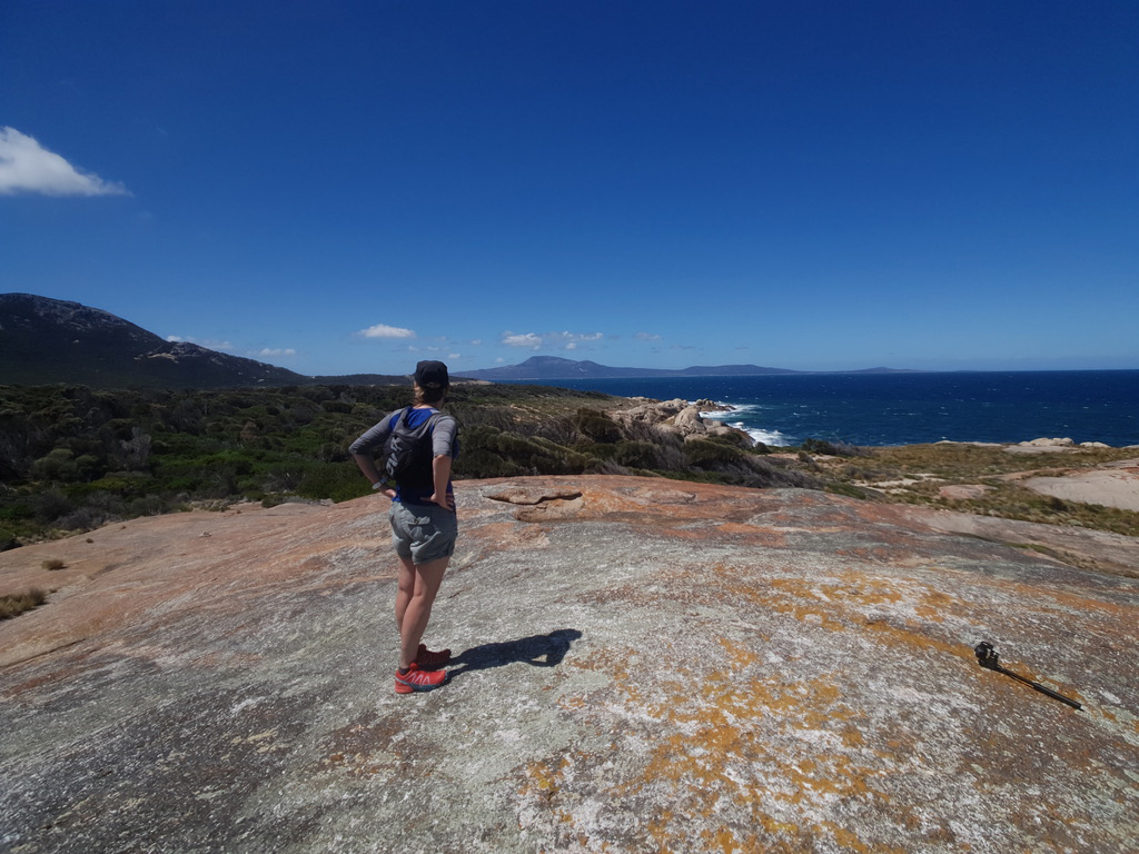
Most keen hikers will know that Tasmania is the one place in Australia that offers a true wilderness hiking experiences, with the Overland Track on the bucket list for most people outside Australia. Flinders Island might not offer the complete wilderness experience like some parts of Tasmania, but it certainly makes up for it with the array of walking opportunities. At every turn the coastline is littered with huge granite boulders cloaked in orange lichen and flanked by some of the most beautiful beaches imaginable. The hills are rugged and the granite architecture gives a sense of scale beyond their height.
Just getting to Flinders Island is part of the adventure. There’s a small cargo ferry that departs Bridport on Tasmania’s north coast only on the high tide every Monday. As a result, it can leave at some seemingly odd times and the journey takes 9 hours. The other alternative, and by far the easiest, is to fly with Sharp Airlines from Essendon Airport near Melbourne in Victoria or Launceston in Tasmania. Sharp operate only a Metroliner with a capacity of 19. There’s something refreshing about being given a laminated boarding card.
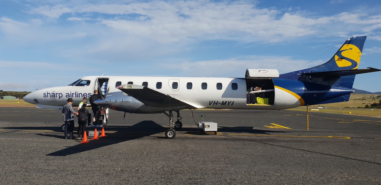
I couldn’t help but feel I was back in the Himalayas heading for some mountain landing strip as I boarded the plane. It’s only a 30-minute flight from Launceston or an extra 15 minutes from Melbourne and the flight alone is worth the journey. As the plane started its descent across the Bass Strait, myriad islands unfolded below. You could see white caps on the ocean and numerous islands fringed by turquoise waters lapping on white sands.
On the final approach I could make out Mt Strzelecki, with its summit shrouded in cloud rising tall from the waters below. I was beginning to get a little excited at the thought of standing on its summit.
With limited options available to travel to Flinders Island, any flights will need to be booked in advance and they can be cancelled due to poor weather. Our flight was delayed on leaving by low cloud, which nearly resulted in a missed connection back to Melbourne.
Hiring a car is the easiest way to explore the island but booking early is a necessity as there’s only one hire company, with limited vehicles available. The distances on the island are not great, with driving times never more than 60 minutes. Most of the roads are gravel and any drive, especially towards the end of the day and early morning, will require caution as you run the gauntlet of avoiding wombats and wallabies.
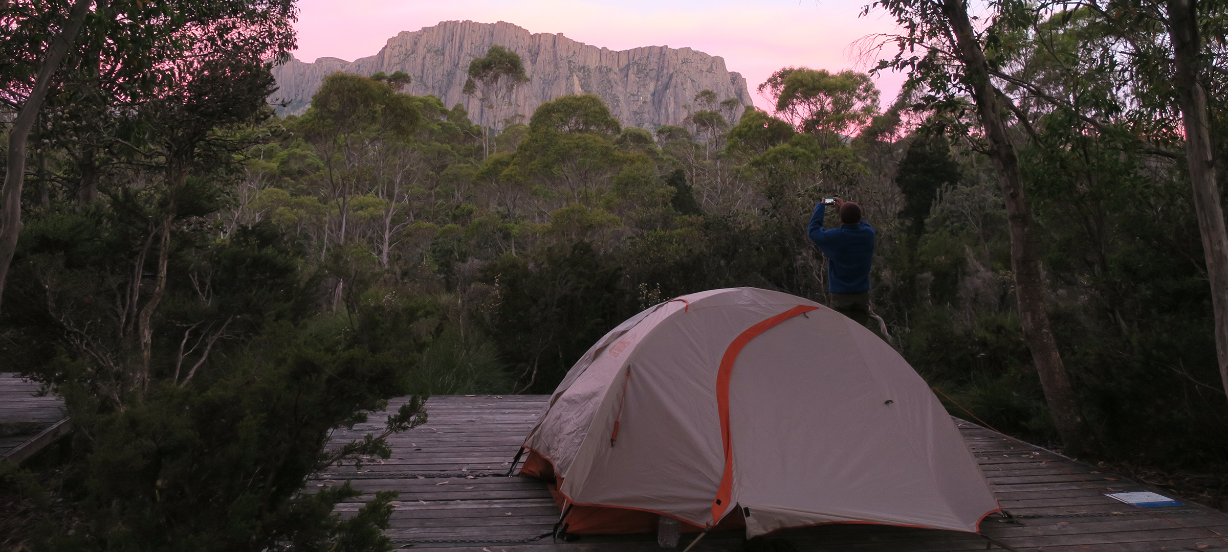
There’s a good range of accommodation across the island, from camping to luxury self-catering beach homes, and being based near Whitemark makes for convenient travel to the different parts of the island. Whitemark is also serviced by a supermarket, petrol station, hotel and the café at Flinders Warf, which serves great local produce. We stayed in touch through their Facebook posts for the latest delicious lunch specials. The island does a lot to promote its local produce and is renowned for its crayfish with a festival dedicated to this delicacy every year. Don’t expect the huge range of products in the supermarket typical of the mainland, but all fresh produce is flown in daily and your needs are well met.
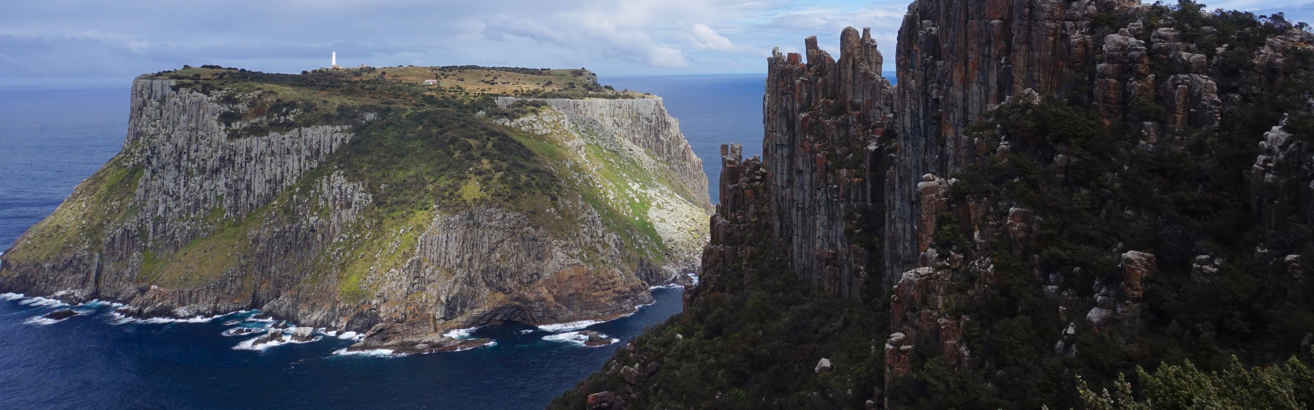
Mt Strzelecki
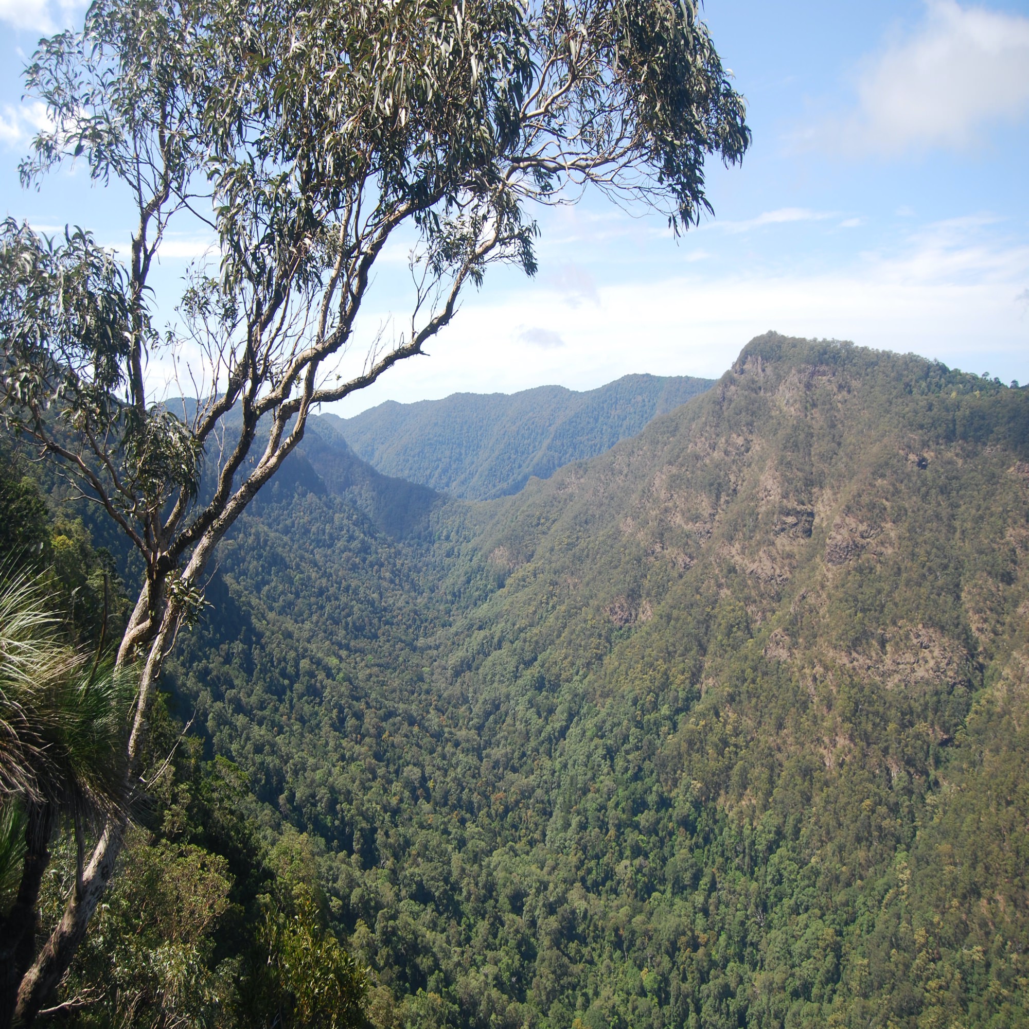
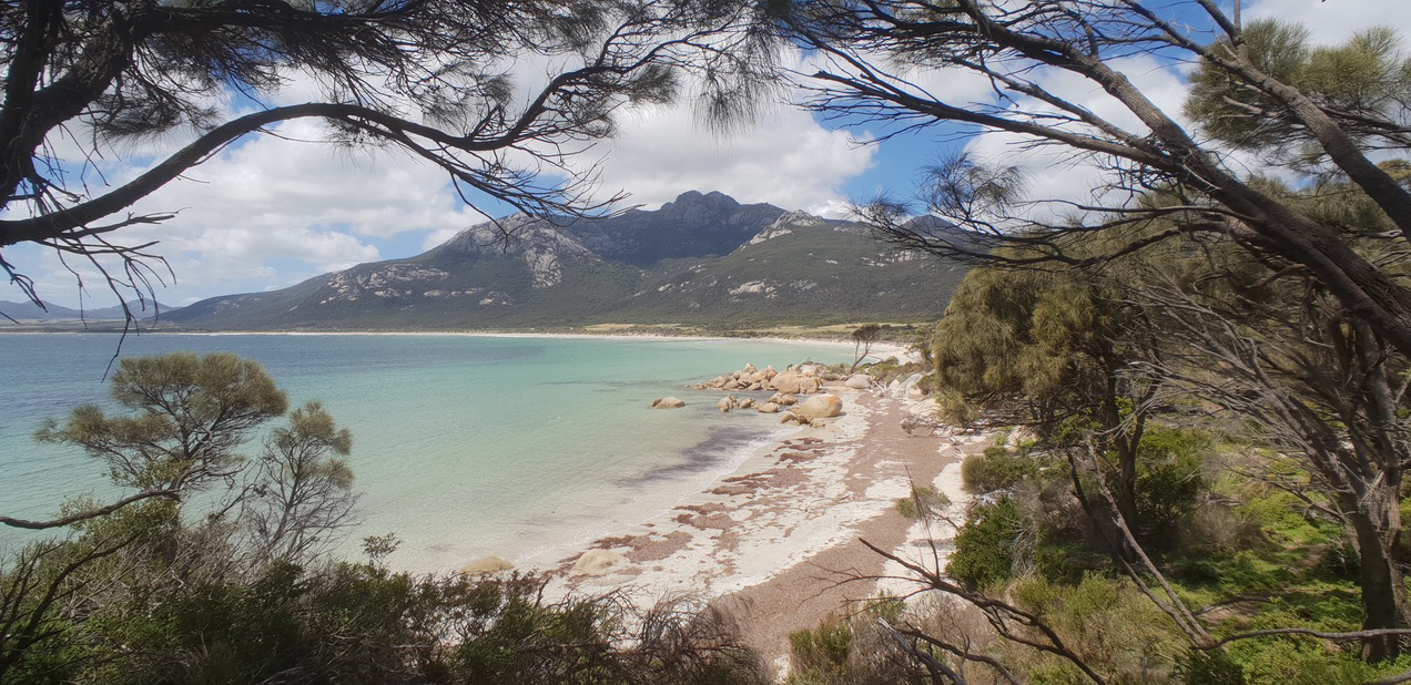
The island offers plenty of hiking opportunities along the remote coastal fringes, but no visit would be complete without an ascent of Mt Strzelecki, which rises to a height of 756m. Although not high by any stretch of the imagination, don’t let that fool you. It’s a tough pull from sea level and the weather here can get pretty wild. There’s still plenty of other hills to conquer beyond Mt Strzelecki and with very little paths or tracks that can make for slow progress. Even the coastal routes will have you scrambling over rocks and boulders in anticipation of the next vista. However, at the end of any hike there’s always a secluded beach close at hand to cool the limbs.
Having been brought up on a diet of Scottish hills I couldn’t but help think that I had been transported back to Harris with its rugged hills of Lewisian gneiss replaced by Devonian granite.
Flinders Island has that wonderful mix of beautiful beaches, clear waters and rocky hills, although the fauna is a little different to that of the Scottish islands!
Mt Strzelecki sits in the national park of the same name and is named after the Polish geologist and explorer Edmund Strzelecki, who climbed the peak in 1842. The park is home to diverse ranges of plants and animals, some of which are endemic to the island. It’s not uncommon to see wombats and pademelons scurrying off the trail into the bush and a keen eye may spot some of the rare orchids like Tunstall’s greenhood.
After a couple of days of exploring other parts of the island, the summit of Mt Strzelecki was cloud free and with a drop in the wind it was the perfect time to tackle the peak. You need to cross over the stile for the start of the hike, where there’s an information board and phytophora station, which requires all walking boots to be cleaned to stop the spread of the fungus that kills heathland plants. The first couple of hundred metres are easy going through sheoak, but the hard work begins as soon as you cross the first creek line. The trail is in great condition, with clever trail maintenance that uses the local granite to create a weaving route to the summit that feels very natural.
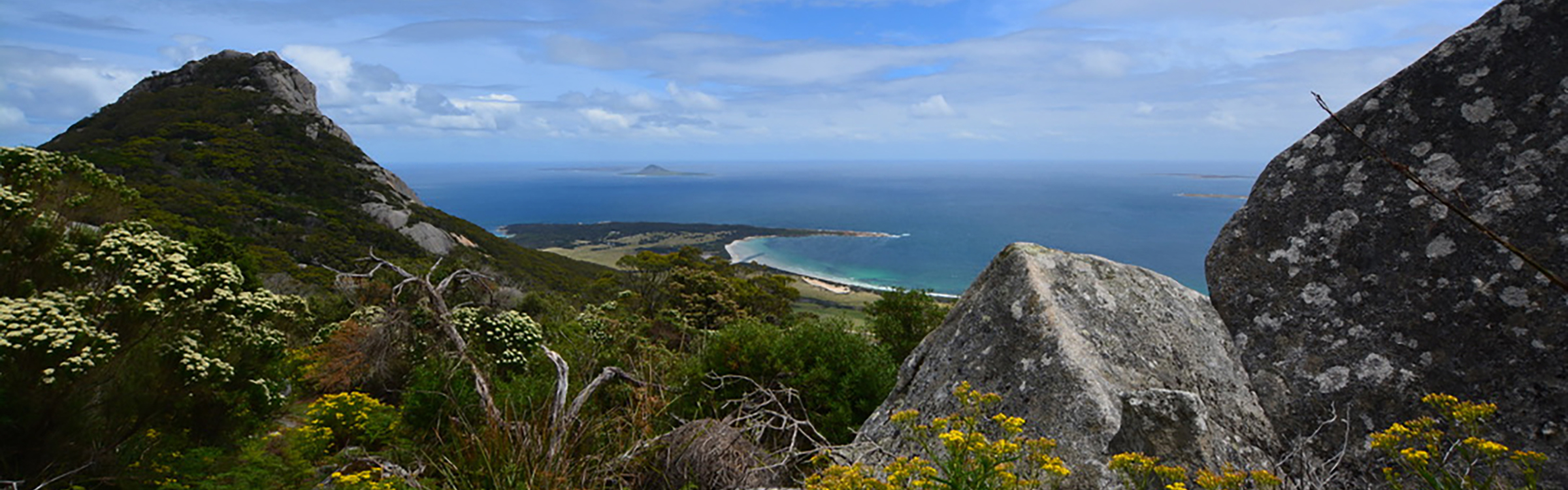
Despite the dense vegetation, there are plenty of resting places to stop, recover and admire the view down to Trouser Point and Fotheringate Bay. Approaching the half-way mark, the route descends into a gully with beautiful gum trees and ferns before arriving at a perfectly placed bench. Even in the height of summer there was water flowing in the creek and the area was awash with flowers, giving it an almost alpine feel. Climbing higher, the vegetation became stunted and the granite buttresses below the summit hung precariously above the trail. Looking up I could make out a face in the rock peering down and standing guard over the lands below.
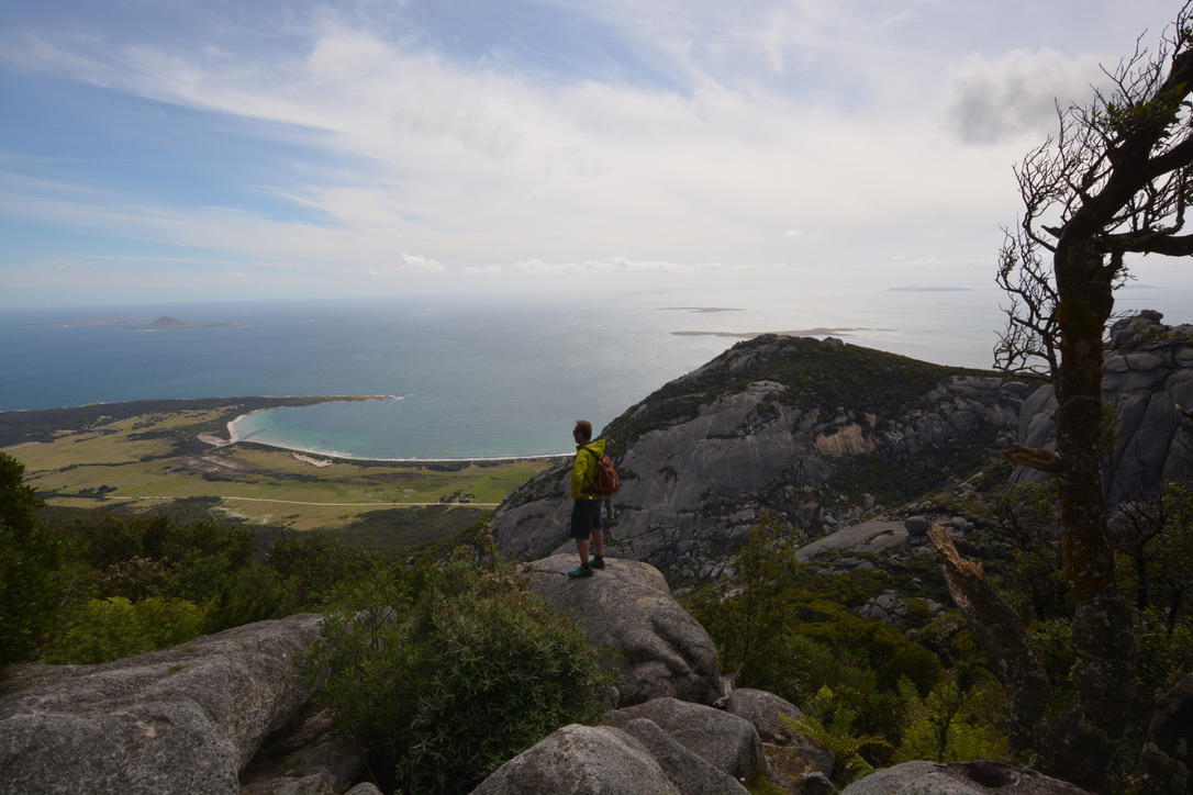
Eventually, the trail emerged out onto a col with a granite platform providing the perfect perch to replenish and add another layer as a cool wind swept through. The final push to the summit climbed through more dense forest that acted as a tunnel before leading up the final steep granite slabs. Orange waymarkers pinned to the rock made for easy navigation and kept me on the right track. For a brief moment there was a sense of exposure as I realised that I was standing on the edge of the buttress I’d been admiring on the ascent. This was short lived as the trail headed to the broad summit.
The wind had abated and the summit was relatively calm and cloud free, although somewhat cool.
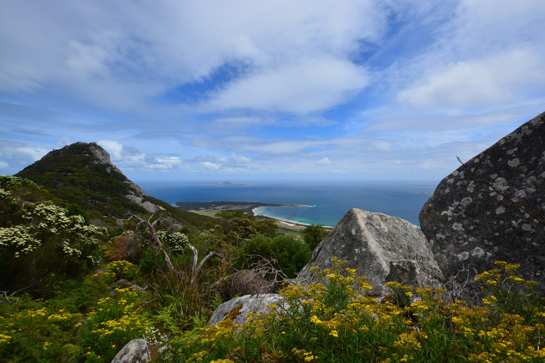
The summit offered a magnificent 360-degree vista; a mosaic of islands all fringed by turquoise waters and the whitest of beaches.
To the south, the ridge continued with more granite tops and beyond I could make out Franklin Sound and on to Cape Barron Island. The Tasmania north coast was elusive as low cloud obscured the view in the distance. To the north lay the town of Whitemark and numerous other rocky hills. On a warm day you’ll be happy of the cooler temperature on the summit and the sight of the clear waters below will soon have you scampering down to the beach for a swim.
The ascent of Mt Strzelecki is one of the three 60 Great Short Walks of Tasmania on Flinders Island. The other is the walk around Trouser Point and if you’ve done Strzelecki first, you’ll have been looking down on Trouser Point for most of the ascent. Although it’s only 2km in length, it provides a unique insight into the geology of the area, with granite and coastal karst. The walk can be extended by heading to the northern point or continuing to Fotheringate Bay as far as Whitemark.
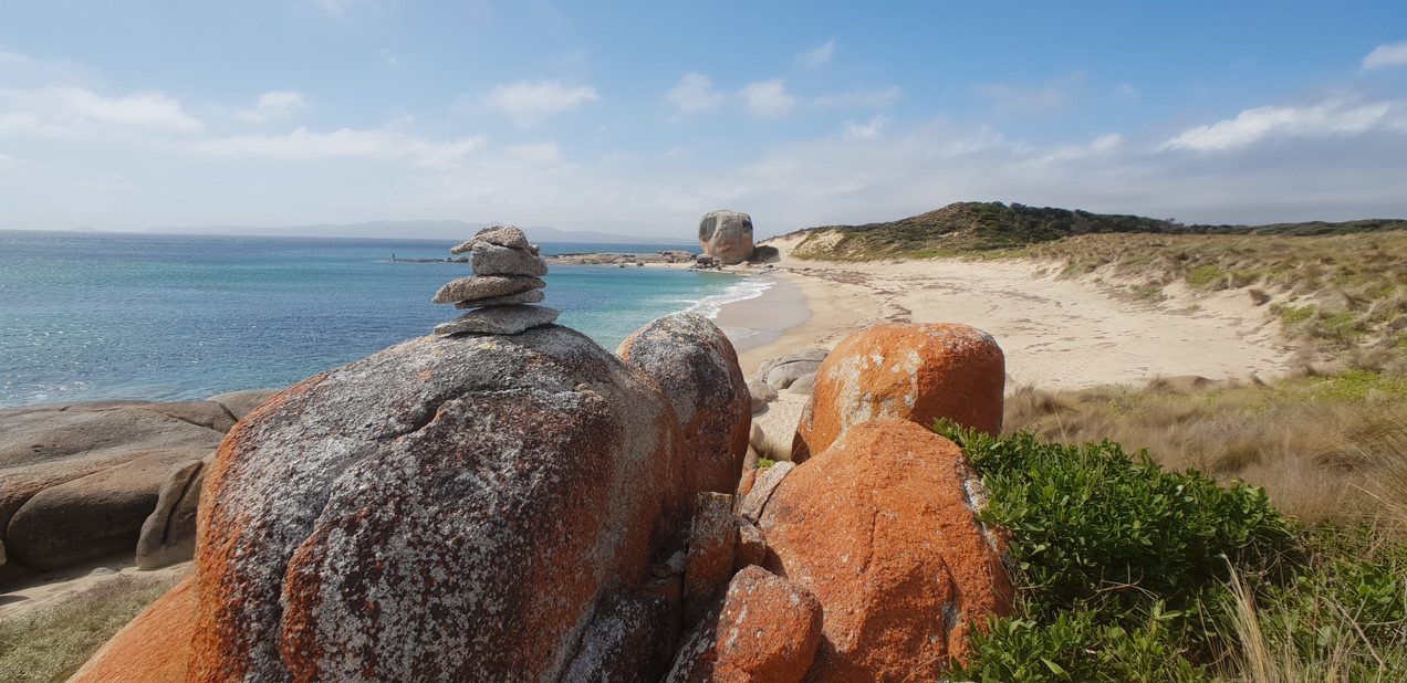
Castle Rock
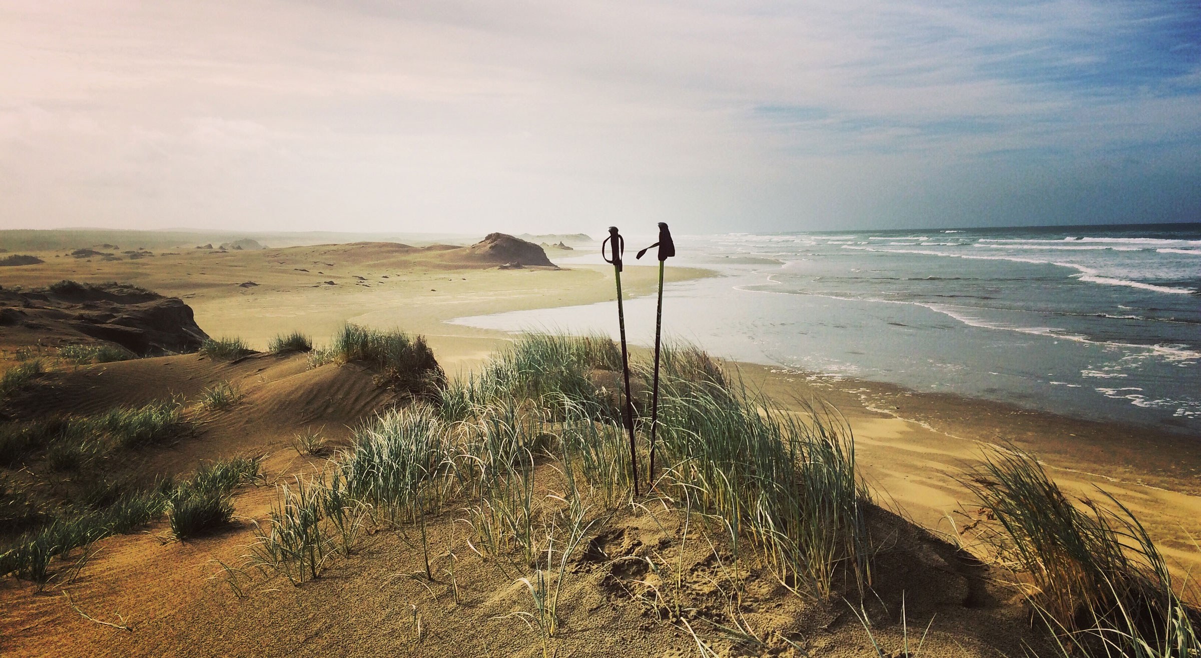
The third of the 60 Great Short Walks is the round-trip to Castle Rock. Although the walk is easy, it’s simply beautiful and encapsulates all that is wonderful about this island. The huge monolithic lump draws you like a magnet as you walk along the pristine sands, jumping from beach to beach. The soft sand can make progress slow so it’s best not to undertake the walk at high tide. The orange clocked granite rocks between the beaches provide countless photographic opportunities.
Beyond the 60 Great Short Walks there’s still plenty of incredible walking to be done and Mt Killiecrankie is a must. The hill sits at the north end of the stunning Killiecrankie Bay and its modest 316m height bellies the fact that this is a tough walk. The first couple of kilometres are along the beach before heading up the southern slopes to the summit trig point where the views are breath-taking, and you’ll be able to make out Inner and Outer Sister Islands to the north.
Killiecrankie is famous for its Killiecrankie Diamonds, otherwise known as Topaz. On the return to the beach you can walk to the outflow of Diamond Creek and do a bit of fossicking for Topaz in the creek bed at low tide. It helps if you know what you’re looking for or you could get carried away collecting quartz!
Killiecrankie is the starting point for other fabulous walks along this section of coastline; either to the south but especially the north to the Dock and Old Man’s Head.
Even with a week’s stay on the island you’ll only have scratched the surface of the opportunities that exist.
Any walks along the coast require a little planning for tide times and sea conditions. However, you’ll always be able to find an alternative. Given that Flinders Island sits in the middle of the Bass Strait, it’s not uncommon for storms to roll in, even in the height of summer. In December 1998 one such storm caused havoc to the fleet competing in the Sydney to Hobart Yacht Race and resulted in the devastating loss of six crew members from the competing yachts.
The week spent on Flinders Island was just after the New Year holidays, but it felt as if it was low season. Temperatures during summer are in the mid 20s, a far cry from mainland Australia. Through winter the weather can be unforgiving, but never too cold. Having spent a week on Bruny Island at the southern tip of Tasmania I can say that it’s still a great time to visit to enjoy the beauty of a winter storm from a cosy fireplace following a day’s hike. Also, there’s always the possibility of capturing Aurora Australis, the southern lights.
Given that Flinders Island is just a stone’s throw from Melbourne, it’s hard to believe that it’s off the radar for most people. So, get in quick as it’s not going to stay that way for long and, like the topaz found on the island, this is a jewel in the middle of the wild waters of the notorious Bass Strait.